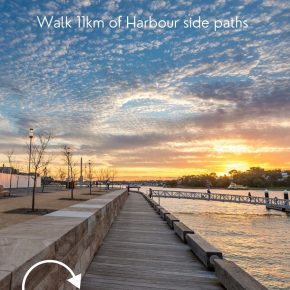
The Sydney Harbour Foreshore Walk takes you from Woolloomooloo all the way to Pyrmont following the waterfront. This 11km path is mainly flat, and there are very few stairs, none that you can not detour around, making this the perfect family-friendly walk.
This page contains affiliate links. You can find our full disclosure policy here.
Tips for enjoying the Sydney Foreshore Walk
All along the route, you will find cafes, restaurants, bars, picnic spots and, most importantly, public transport connections.
If you are visiting Sydney on a quick trip, this walk ticks off many of the city’s best views.
While we have walked each section of the route before, this week we tackled it in one go so we could create this photo guide for anyone wanting to give it a go.
What will you see along the route?
The Foreshore Walk takes in many of the city’s biggest sites and is especially great for visitors.
- Woolloomooloo Wharf
- Mrs Macquaries Chair
- Royal Botanic Gardens
- Sydney Opera House
- Museum of Contemporary Art
- Sydney Harbour Bridge
- Barangaroo Reserve
- Darling Harbour
- Pyrmont
You can follow the Sydney Harbour Foreshore Walk route in either direction – there is a good supply of watering holes at both ends! This is the ultimate Harbour walk
Foreshore Walk Map
How long is the Foreshore Walk?
The total distance of the foreshore walk on Sydney Harbour depends on how strictly you follow the foreshore – we went down the full length of three of the wharves and skipped the rest, we walked most of the way around the Opera House and our total was 11.4km.
We have added distance points through the page so if you want to you can complete this in stages as time allows.
Most of the walk is dog-friendly – you just need to skip the Royal Botanic Garden by detouring via Art Gallery Road and Macquarie Street.
You may choose to cover the Woolloomooloo to Barangaroo Walk one dy or perhaps a Darling Harbour to Circular Quay walk and do sections as you are exploring the city.
How long does it take to complete the Sydney Harbour Foreshore Walk?
The walk took us about 3 hours, allowing for lots of photo stops. You can probably do it in about 2hrs 20. You can see how fast you can get there, or you can meander in and out of the buildings, parks and gardens along the way and spend an entire day on the route. It would also make a great morning run if that’s your thing!
Beginning at Woolloomooloo
To reach the start of the walk, we took the train to Kings Cross Station and then the Butler Stairs on Victoria Street. This adds about ten minutes to the walking time but easier than finding parking and having to return to collect your car.
The walk officially starts at the historic Finger Wharf on Cowper Wharf Road. At 400m long, the wharf was, at the time it was completed, the largest wooden structure in the world.
Woolloomooloo Wharf was the departure point for many Australians who headed to fight in WW1 and WW2. Thankfully it was saved from demolition in 1991 when workers imposed a green ban.
Today the wharf is home to 300 apartments, some with famous occupants, 104 hotel rooms and 6 restaurants.
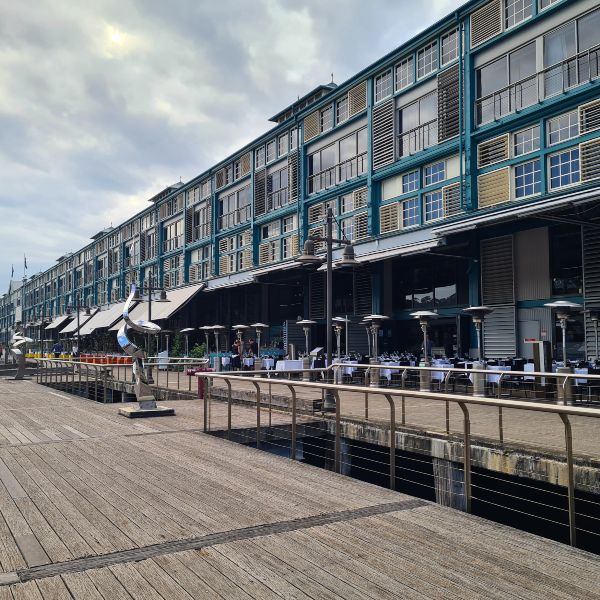
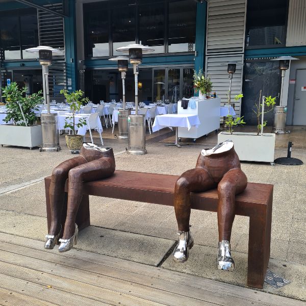
Along with being a beautiful structure itself, thanks to Art Park Australia, an organisation that places contemporary Aussie sculpture in public spaces, there are over 80 sculptures placed along the deck and inside the building.
Once you have taken a good look around, it’s time to get walking. Follow the path around past the terraces and onto the short boardwalk. You will see some old stone steps that will take you up to the next level (about 10 or so).
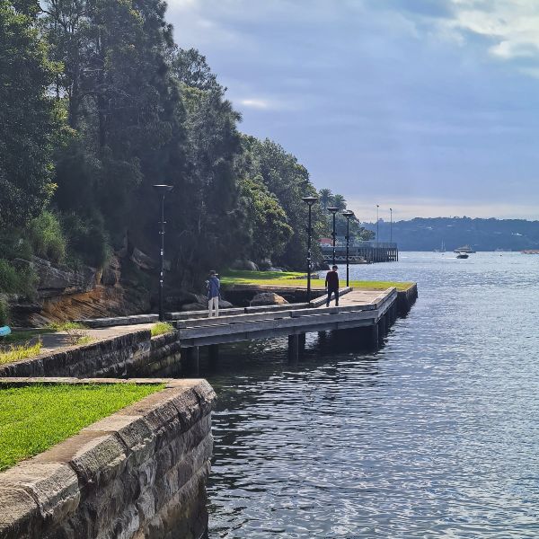
Alternatively, you can take the footpath and steps behind the terraces, which is flatter, and while it still has some steps, these are more even and better for prams or anyone not real sure on their feet.
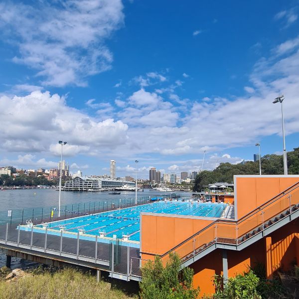
Once at the top of the stairs, the path follows Mrs Macquaries Road past Andrew Boy Charlton Pool and the famous Mrs Macquarie’s Chair and the iconic Sydney postcard view.
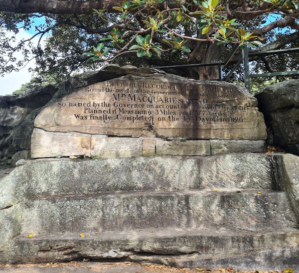
Royal Botanic Gardens
Just past the point is the official gate into the Royal Botanic Garden, is Victoria Lodge – home to Busby’s Bar. Opened seven days a week in summer, in the cooler months outside holiday periods, it is only open on weekends.
Follow the path around Farm Cove; if you have not explored the gardens before feel free to detour here for a while and take a look around.
You might like to check out:
- Government House
- The Calyx
- Botanic House or Botanic Gardens Cafe
- The topiary animals – an echidna, cassowary, wasp, bees and more
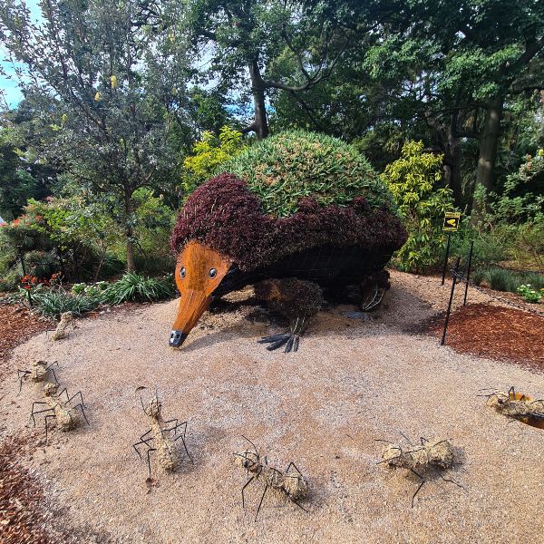
Continue to Bennelong Lawns for a great view of the Opera House from above before you head down the stairs and onto the Opera House forecourt.
Distance to this point is 2.7km
Sydney Opera House
Have you ever walked right around the Opera House? If not, now is your chance. When you reach the front of the building, you will find a set of steps on the western side of the building; occasionally, you may see the friendly seal that pops in to visit. He is a long-nosed fur sea and possibly lives outside the heads near Macquarie Lighthouse at Watsons Bay.
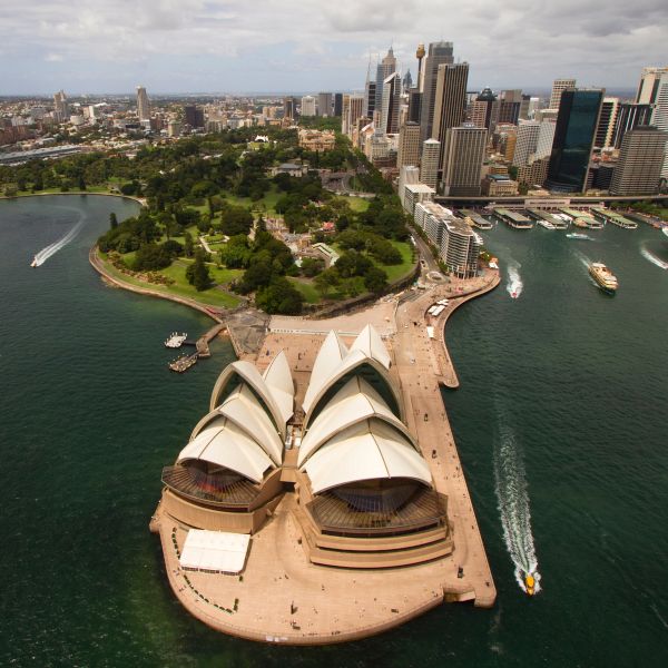
Dubbagullee is the indigenous name for Bennelong Point
Detour: This one is for the photographers – As you make your way towards the quay, you will notice a glass elevator that leads up onto the Cahill Expressway. It offers a great view of the harbour.
Circular Quay, The Rocks and Dawes Point
Continue around the quay to Campbells Cove/Meeliyahwool. Along the way, you will pass Cadman’s Cottage and a small park that is home to a statue of Captain William Bligh.
Detour: Take the escalator to the second level of the Overseas Passenger Terminal and make your way to the northern end. In the round tower at the end is a public observation tower, a favourite spot to capture the Vivid Sydney Light show.
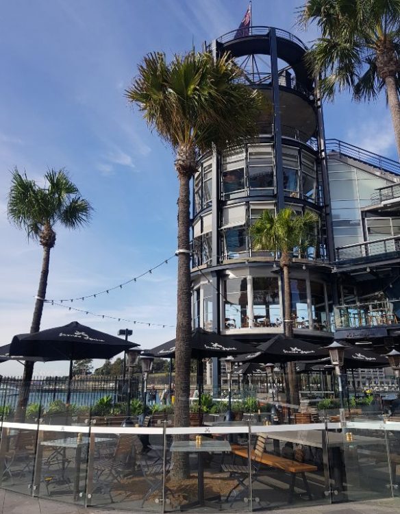
Alternatively, keep walking around the path past the recently renovated historic Campbells Stores and the luxury hotel, the Park Hyatt, which must have the best views in the city. This is the perfect spot for your Opera House selfie or an easy reflection shot.
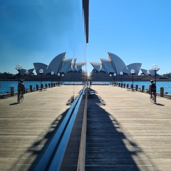
There is a small park right under the bridge, along with some palm trees. This is the official start of Dawes Point/Tar-ra (the indigenous name).
You can find a detailed self-guided Rocks walking tour here if you want to explore further.
If you are getting tired, this is a fantastic spot to take a rest, perhaps in one of the areas historic pubs or just sit and watch the harbour traffic sail past from the park under the bridge.
Distance to this point 4.7km
Detour: Take a walk along Lower Fort Street, fifteen of the properties on this street are heritage listed, and many have been restored to their former glory.
Millers Point and Walsh Bay Wharves Precinct
As you make your way under the Harbour Bridge, you are now entering the area known as Millers Point, some of the wharves are considered to be in Dawes Point, but most locals describe the whole area as Millers Point.
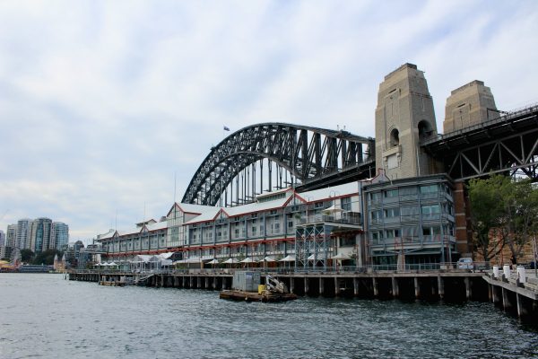
Built between 1911 and 1921, this entire wharf area is listed on the National Heritage Register. After years of service, the wharves are now restored and offer a mix of bars, cafes, theatres, and apartments.
Wharves 2, 3 and 4 make up the Walsh Bay Wharves Precinct. Wharf 4/5 is home to several arts and hospitality venues including; Sydney Dance Company, The Wharf Theatre and Bangarra Dance Company. Directly across the road is the Roslyn Packer Theatre.
Wharf 2 host the Australian Theatre for Young People, Bell Shakespeare Company and the Australian Chamber Orchestra when the current renovations are complete.
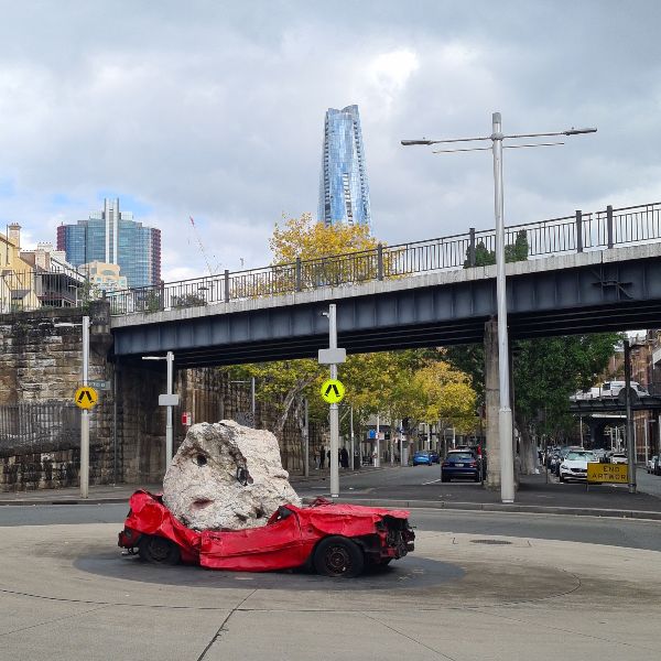
Sitting in the middle of the road, as you round the corner from Dawes Point, you will find a squashed red car. Jimmie Durham created this installation from a 1999 Ford Festiva hatchback purchased in Homebush and a two-tonne quartz boulder from a Central Coast quarry.
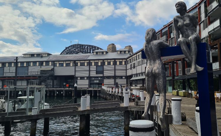
Another favourite is these two swimmers who are part of the Art Park Australia collection. There are plenty of interesting works to discover as you explore the wharves. See details on all the sculptures here.
We also have a fun sculpture walk to help you discover more interesting walks.
Distance to this point 5.3km
Barangaroo
Barangaroo is made up of three sections; at the north, the headland, you have Barangaroo Reserve, followed by Barangaroo Central – the section that is not quite complete, and finally Barangaroo South – a food lover’s paradise.
Just a couple of years ago, the Barangaroo Headland was a concrete wharf devoid of life. Today we have a six-hectare reserve planted with species present on the site when the First Fleet hit town.
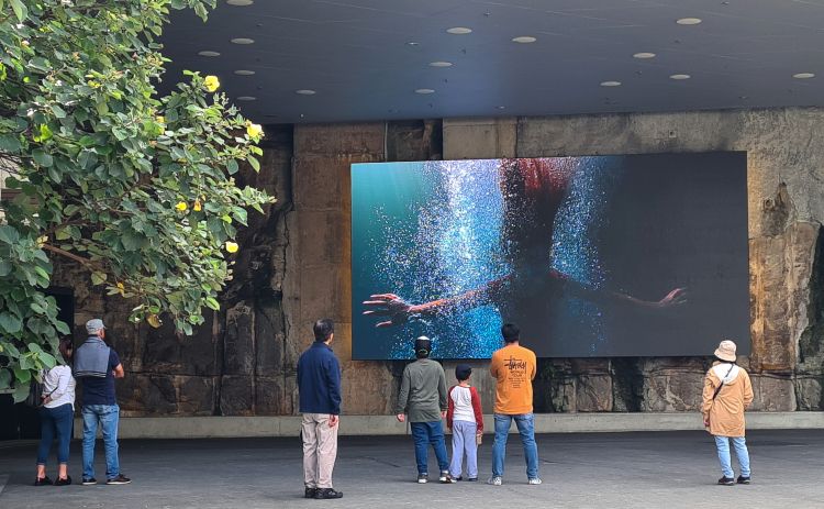
As you enter, the reserve follow signs for Wulugul Walk, the name given to the foreshore path here. Follow the path around the water, past the Crown building to Watermans Cove.
Stargazers Lawn at Barangaroo Reserve is a lovely spot to watch the sunset.
Detour: As you round the path, you will see the Barangaroo Cutaway, an underground space for events and exhibitions. At the entry is an audiovisual installation titled Wellama, which means ‘to come back” in the language of the Sydney people. The video runs for about 10 minutes.
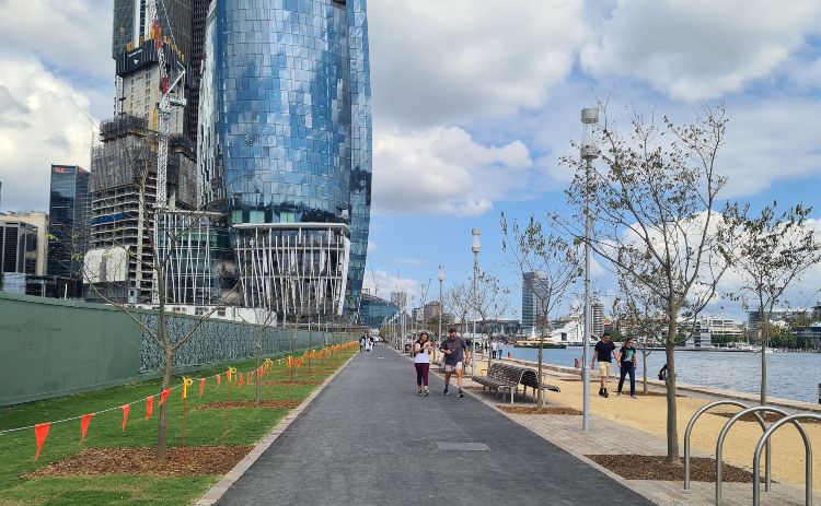
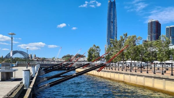
Central Barangaroo is the next part along the path, it is still under construction, and it is this 400m section of the pathway that opened in April 2021, giving us the missing piece in this 11km path. The key tenant here is Crown Sydney at 271.3m (890 ft) with 75 floors, and it is the tallest building in Sydney and the 4th tallest in the county.
This central section will also be the location of the metro due to open in 2024.
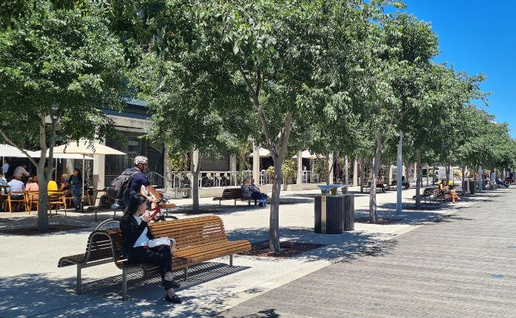
The South end of Barangaroo is home to bars, restaurants and speciality stores. There are some fantastic dining options here and several good choices for food on the go. If you want to grab a bite to keep you going, try Bourke Street Bakery or perhaps a treat from RivaReno Gelato. For coffee, you have Toby’s Estate, Campos or Bourke Street. Check all the options here.
Distance to this point: 8km
Darling Harbour
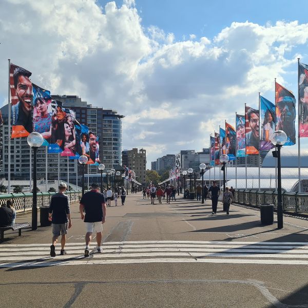
Barangaroo morphs into King Street Wharf, which soon after becomes Darling Harbour. Officially it begins at the Madame Tussauds and Sea Life Sydney. We are only going to see a little of Darling Harbour today as we make our way to Pyrmont Bridge and head across to Pyrmont and the last stage of our walk.
Pyrmont
Your walk-through Pyrmont will give you a chance to soak up some of our maritime history. As you come off the bridge, make your way down to the wharf in front of the Australian National Maritime Museum and stroll past the ships and the Cape Bowling Green Lighthouse. You will also pass several historic ships, including a replica of the Endeavor.
Detour: If you have time to visit the Maritime Museum – tickets include guided tours of these ships.
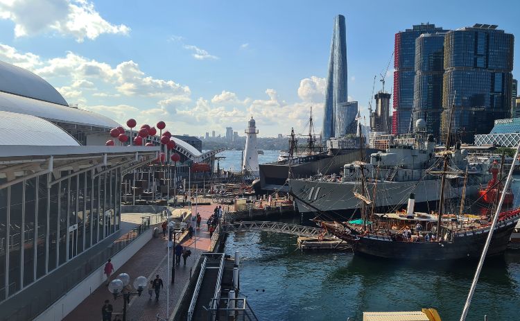
At the end of the wharf is the charming Cape Bowling Green Lighthouse which originally stood in North Queensland but was moved to the Museum in 1994. It was opened for tours but recently closed due to safety concerns. Hopefully, it will reopen in the future.
Detour: Also along this section of the walk are a number of interesting sculptures so take you time to hunt them down.
Distance to this point: 9.3km
Pyrmont Bay and Wharves
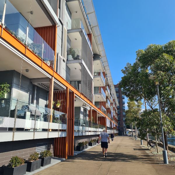
Up next are three more wharves, home to Sydney Heritage Fleet, fancy apartments, tech and entertainment businesses like Google and Endemol Shine. Not a lot to see here but some nice views back towards the city and a chance to see how the wharves have been repurposed into modern offices and homes.
Pirrama Park
several bbq areas, this is a popular picnic spot for families. It also plays host to a number of events throughout the year including a NYE fireworks party.
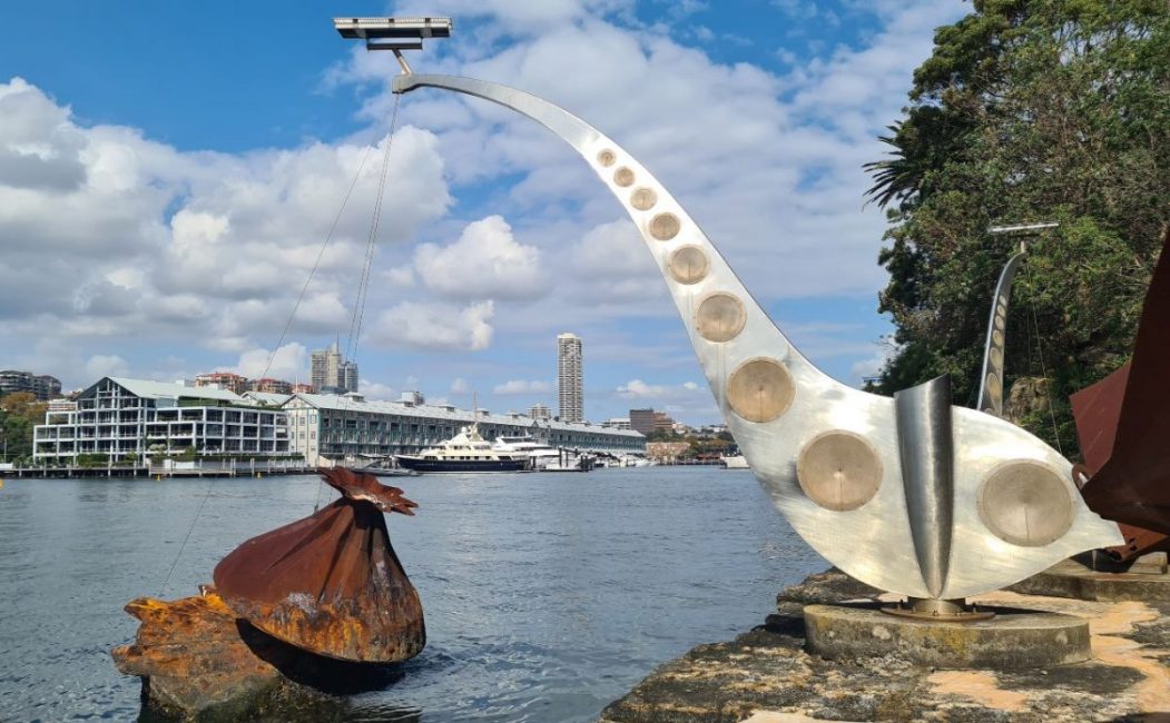
The first highlight in the park is Time and Tide, a kinetic sculpture by artists Jennifer Turpin and Michaelie Crawford. Depending on the tide is moves gently or sometimes with a bit more gusto.
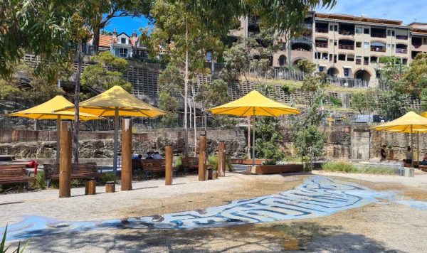
Pirrama Park is also home to a cafe, and playground with a water play that is great on warm summer days.
Waterfront Park and Anzac Bridge
The final stop on our Sydney Harbour Foreshore Walk and the Anzac Bridge is almost directly in front of you.
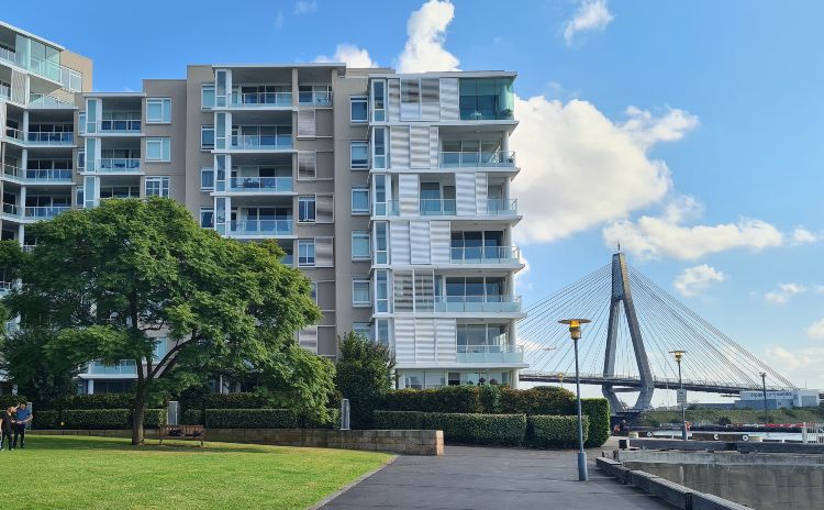
Also along this stretch is the popular cafe Zebra Lounge.
As you round the bend near the bridge, you come to the home base of a few of Sydney’s Dragon Boat clubs. Arrive here in the morning, and you might be lucky enough to see them training in Johnstons Bay.
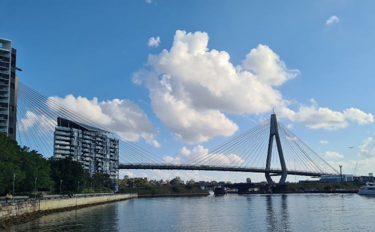
Distance to this point: 11.3km
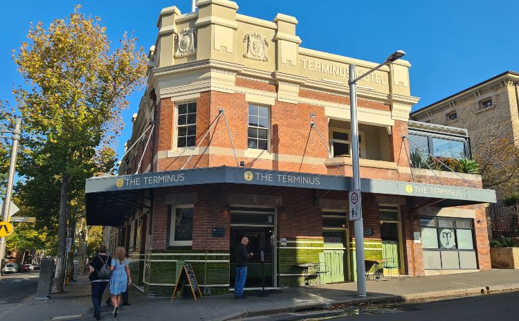
You have officially completed the Sydney Harbour Foreshore walk. Well done! Make your way up to John Street for the light rail back to the city or visit one of the pubs. The Terminus has recently been restored and has the most beautiful tiled heritage bar. Well worth a look if you are passing.
Alternatively, follow the road around the bridge and you will find your way to Sydney Fish Market for a well-earned serving of fish and chips!
Want more Sydney walks to challenge yourself with? Check out some of these;
- Taronga Zoo to Balmoral Beach
- Bondi to Coogee
- Hermitage Foreshore Walk in Rose Bay
- The 80km Bondi to Manly walk
- Harbour Foreshore walks in Sydney
Have questions about things to see and do in Sydney?
Head over and join our Facebook Group and we will be happy to help.


I love the look of this walk! Last year I did the Spit Bridge to Manly & Bondi to Coogee walks & really enjoyed them. I will definitely put this one on my list for the next time I’m allowed into the country! 😉
I’ve done most of this walk in sections, but it’s great to see it all laid out like this. I just need to get to the Pyrmont end to complete it all – and I need to get back to the gardens, just to see that echidna!
Welcome to GOING SOUTH MINIBUSES, the most reliable and value priced bus service in the southern areas of Adelaide. Based at Hackham we service all suburbs and towns on the Fleurieu peninsula. Call us at 0466189968 for a free quote and to answer any questions you may have in relation to your bus charter. Personalized service and reliability is our aim to customers and we can provide a bus size to suit your requirements.