Taronga to Balmoral Walk: Complete Guide with Map
The Taronga to Balmoral Walk is one of Sydney’s most scenic harbour walks, taking you on a 6km trail from Taronga Zoo Wharf through pristine bushland to beautiful Balmoral Beach. This easy‑to‑moderate walk offers spectacular harbour views, secluded swimming spots, and layers of Australian history along the way.
This is my favourite walk in Sydney, the one I take all my visitors on, and every time I do this track I’m grateful that this part of the harbour was kept accessible for everyone. In this guide, you’ll find the best places to stop, where to eat and grab coffee, and exactly how to get to and from the Taronga Zoo to Balmoral Beach walk by ferry and bus.
Taronga to Balmoral walk at a glance
- Distance: 6–6.5km one way (depending on exact route)
- Time: 2–3 hours including photo and swim stops
- Start: Taronga Zoo Wharf (ferry from Circular Quay)
- Finish: Balmoral Beach
- Grade: Easy–moderate with some stairs (not suitable for prams)
- Best direction: Taronga Zoo to Balmoral Beach (reverse also possible)
Why choose the Taronga to Balmoral walk
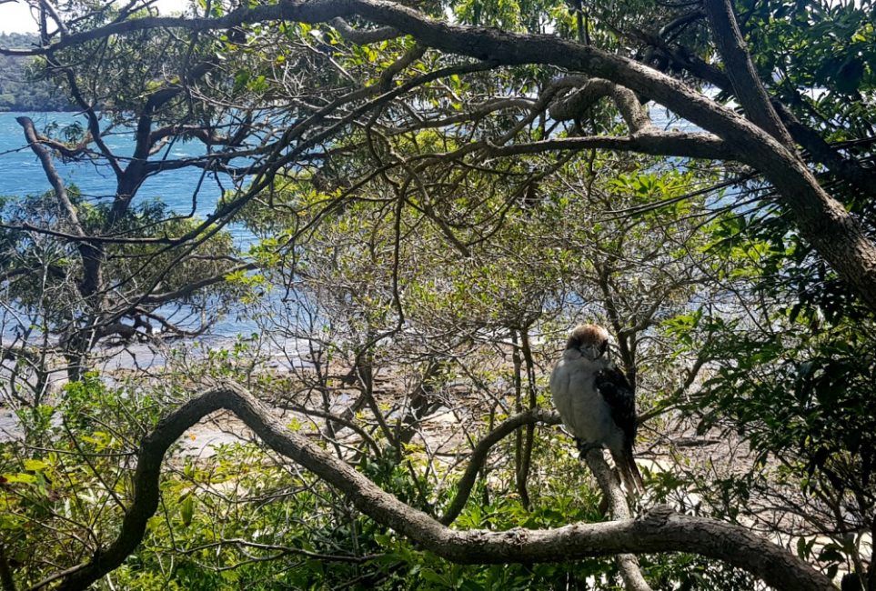
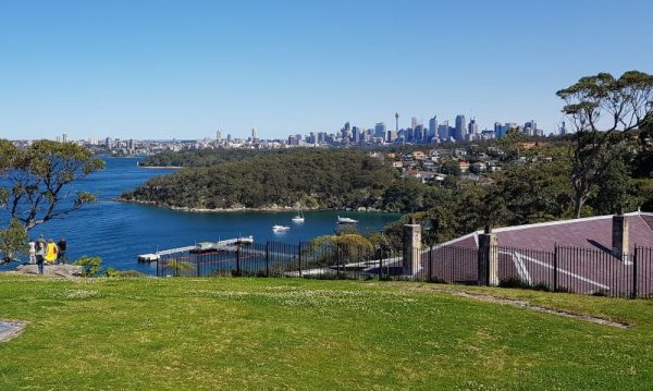
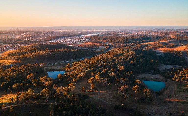
This harbour walk is perfect for travellers seeking Sydney’s natural beauty without the tourist crowds. Despite the city skyline across the water, you’ll feel miles from any city as you wind through Sydney Harbour National Park’s pristine bushland.
The track is well-maintained with clear signage, making it ideal for first-time visitors to Sydney. You can turn back at Chowder Bay (4km) if you prefer a shorter walk, or continue to Balmoral Beach for the full experience.
Can you walk from Balmoral to Taronga Zoo?
- Yes, the track works perfectly in reverse as the Balmoral to Taronga walk or Balmoral Beach to Taronga Zoo walk.
- Note that starting at Balmoral means tackling the steeper stairs earlier, and you’ll finish at Taronga Zoo Wharf for an easy ferry back to Circular Quay.
What makes this Sydney harbour walk unique?
Unlike Sydney’s busy beach walks, this track offers a perfect blend of urban harbour views and untouched Australian bushland. Here’s what draws locals and savvy travellers back again and again:
- Sydney Harbour National Park’s pristine bushland and native wildlife
- Spectacular harbour views from multiple lookout points
- Historic naval base remnants and Aboriginal heritage sites
- Secluded harbour beaches perfect for swimming
- Several excellent cafes and restaurants at Chowder Bay
- Sydney Harbour Marine Institute, where you can learn about marine life
The combination of natural beauty, historical significance, and modern amenities makes this walk stand out from other Sydney harbour experiences.
How long does the Taronga to Balmoral walk take?
Plan for 2 hours of steady walking for the full 6km route. If you’re stopping frequently for photos, swimming, or exploring the historical sites, allow 2.5-3 hours. The shorter 4km version to Chowder Bay takes about 1.5 hours.
Most visitors find the pacing flexible—you can rush through in 90 minutes or spend a full day exploring every beach and historical marker along the way.
Step-by-step guide to the Taronga to Balmoral Beach walk
This 6km track starts below the zoo wharf and takes about two hours at an average pace. You can finish at the 4km point at Chowder Bay and backtrack to the wharf, or take a bus near Georges Head or Balmoral back.
Athol Bay Beach and Athol Hall
Walking time from start: 15 minutes (700m)
Your first reward comes quickly—a detour to one of Sydney harbour’s best-kept secret beaches. Athol Beach attracts boaties who anchor here for lunch and swimming, but it’s usually empty enough for a peaceful swim.
This harbour beach is usually pretty empty and safe if you feel like a quiet swim.
An alternate path leads to Athol Hall, a historic building from 1908 that tells Sydney’s social history. Originally a private residence, it became the Athol Gardens Hotel in the 1860s and hosted dances and parties. A cafe operates Friday to Sunday but it’s mostly used to for weddings (my daughter got married here).
Bradleys Head Amphitheatre
Walking time from start: 25 minutes (1.5km)
The story behind this headland reveals how close Sydney came to losing this natural treasure. In 1895, developers planned to level this land for coal mining. Thankfully, protesters halted the development and saved it for us to enjoy today.
The headland honours Lieutenant Bradley of the HMS Sirius, a cartographer who mapped much of the early colony.
The modern amphitheatre has an interesting Hollywood connection—it was built after Mission Impossible 2 used the site for a stunt involving Tom Cruise rescuing a hostage. These days it hosts weddings and occasionally musical performances.
The rock jetty serves as both a popular fishing spot and wedding photography location with the city providing a dramatic backdrop. The parkland offers shaded areas perfect for picnics, and Bradley’s Head makes an excellent sunset spot—easily walkable back to the zoo wharf in the fading light.
Continue walking to find a lighthouse, old military fortifications, and the mast of HMAS Sydney, commemorating Australian sailors killed in the war.
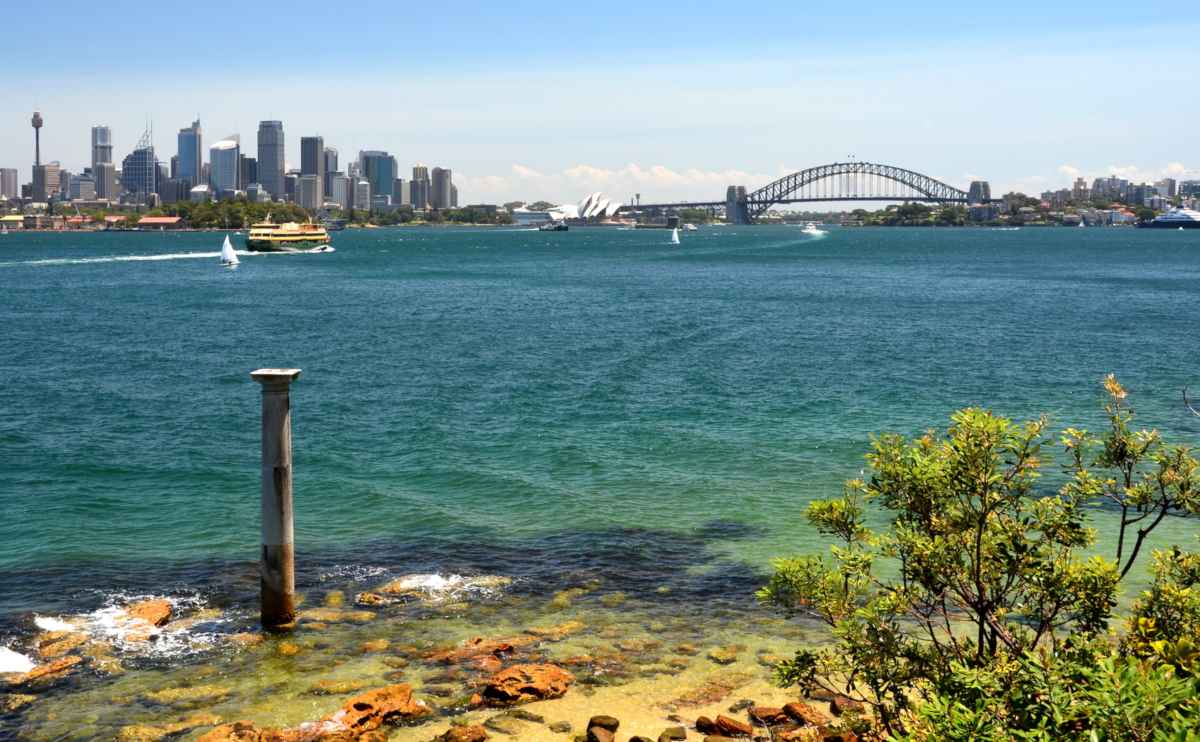
One last oddity before we move on, look out into the water just before the lighthouse, and you will see a Doric-style column sticking up out of the water. The pillar was from the Sydney General Post Office. When the building was demolished, it was moved here to mark one nautical mile to Fort Denison.
Continue on the track, which is now called Taylor’s Bay Track, to surprise surprise, Taylor’s Bay!
Taylors Bay
Walking time from start: 40 minutes (2.6km)
This track is bordered by a narrow strip of harbourside rainforest lined with Sydney Red Gums, and the scrub can get thick. It’s hard to believe you are just a few kilometres from the city centre.
Keep your eyes open for Aboriginal kangaroo engravings near a small stream—these ancient artworks connect you to the area’s first inhabitants.
Taylors Bay holds a sobering piece of World War II history. This is where three Japanese midget submarines entered Sydney Harbour and fired a torpedo at HMAS Kuttabul, killing 21 sailors. One submarine was destroyed by its crew when caught in protective netting, while the other two escaped.
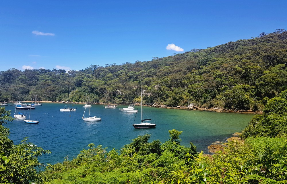
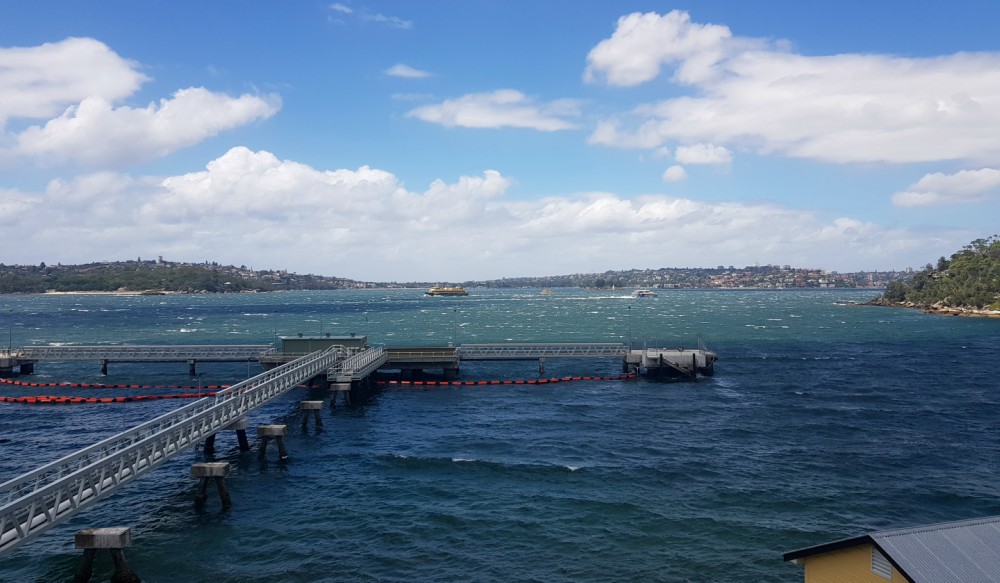
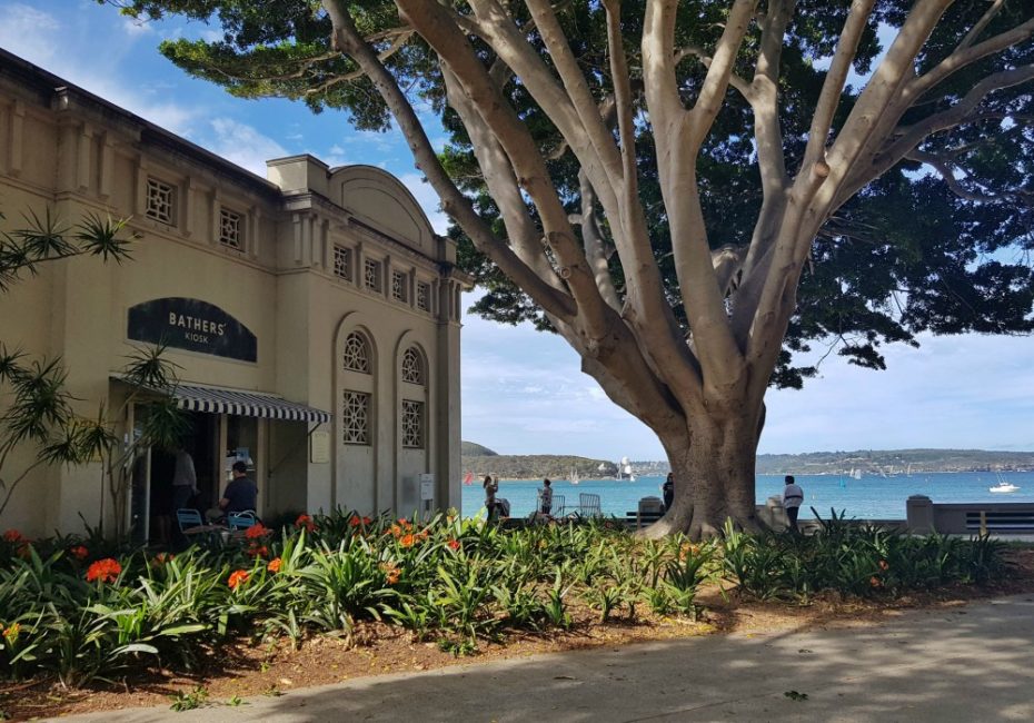
Chowder Bay and Clifton Gardens
Walking time from start: 1 hour (3.8km)
The history of Chowder Bay reveals Sydney’s maritime past. In the 1830s, a whaling station operated here, with American whalers giving the bay its name after the chowder they made from their catch. When whaling ended in the 1890s, the Submarine Mining Corps built a base on the site.
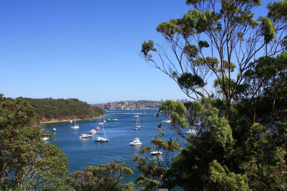
Today, the bay offers front-row seats to harbour traffic and serves as the starting line for the famous Sydney to Hobart Yacht Race.
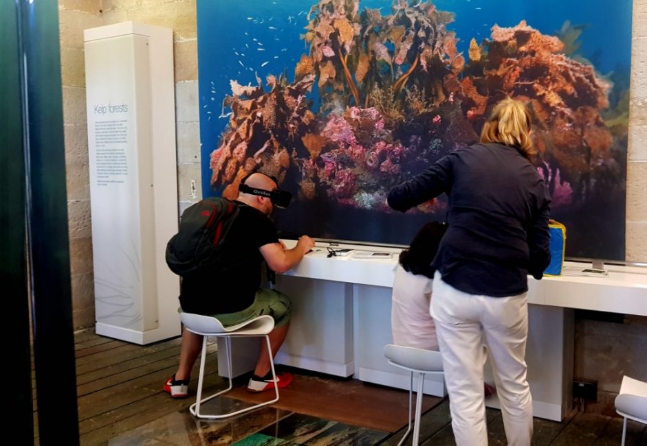
Institute of Marine Science (SIMS) has taken over some old buildings, including a small museum highlighting the area’s marine life and providing geographic detail on the harbour floor.
Their virtual dive simulator lets you explore Sydney Harbour’s underwater world without getting wet—perfect for understanding what lies beneath the surface.
The centre is open to the public one weekend a month, and luckily this coincided with our last visit.
Here’s your decision point. If you have energy, continue the final 2km (40 minutes) to Balmoral—one of Sydney’s most beautiful harbour beaches that’s absolutely worth the extra effort.
If you’re ready to finish, explore the excellent dining options here before catching the 244 bus back to Wynyard Station from near Drift Cafe on Chowder Bay Road.
L’Heritage, the French restaurant on Chowder Bay Road, offers exceptional dining with harbour views that are hard to beat.
Georges Heights lookout and Headland Park
For those continuing to Balmoral, walk up the stairs behind Chowder Bay’s buildings and follow the road to Drift Cafe. From here, you can take a shortcut to Balmoral or continue straight to Middle Head for more spectacular views.
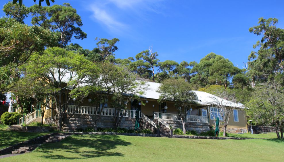
Bungaree’s Walkway—named after an influential Aboriginal leader—offers the quicker, if more physically taxing route to Georges Head Lookout. Take the staircase to the right of the cafe and follow the signs for Gunners Barracks or Georges Heights Lookout.
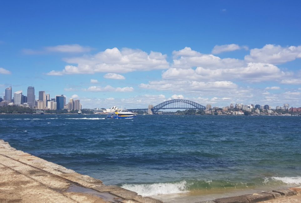
The steep stairs challenge your legs but reward you with Georges Heights lookout’s sweeping 180-degree views across the harbour, taking in Manly, Vaucluse, and the city skyline.
During WW2, Italian prisoners of war were housed in huts near this beach.
This area forms part of Headlands Park, which includes an artists’ village worth exploring. To reach Balmoral, retrace your steps to the main track, follow it to Middle Head Road, cross the road, and take the staircase down to Balmoral Beach.
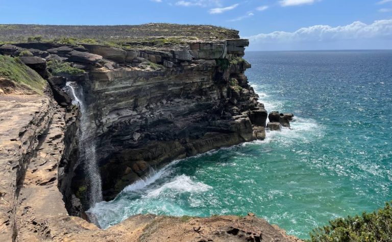
The alternative route follows Chowder Bay Road past Obelisk Beach—Sydney’s designated clothing-optional beach for those who prefer to swim au naturel.
Continue to Middle Head, then retrace your steps up steep Middle Head Road until you reach the long metal staircase that descends to Balmoral Beach.
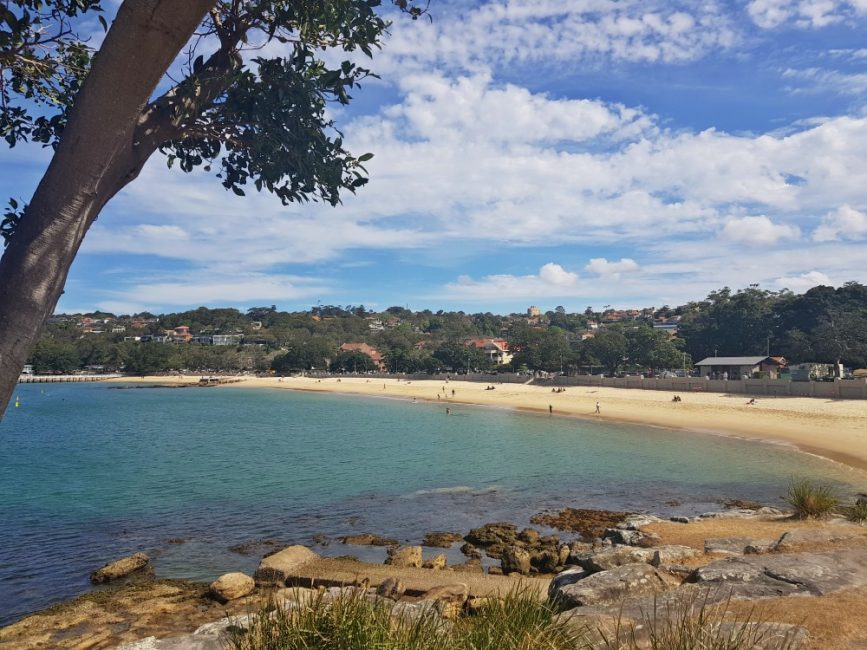
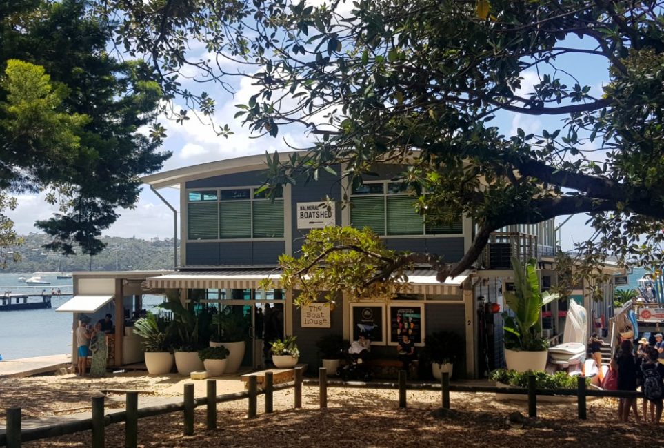
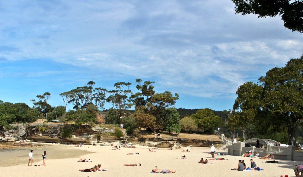
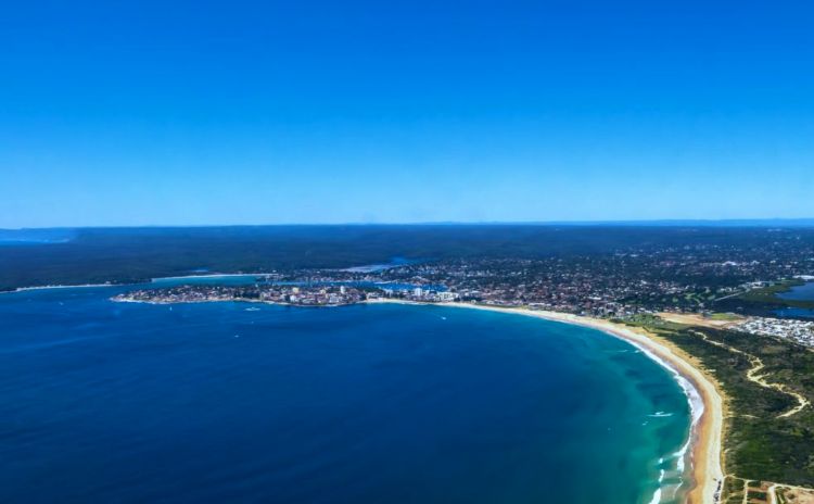
Balmoral Beach
Walking time from start: 2 hours
Many locals consider Balmoral Sydney’s most beautiful harbour beach. Its calm, clear waters, shaded parkland, and excellent harbour views from Rocky Point make it the perfect finale to your walk. Food options range from fine dining to excellent fish and chips.
Pick up fresh seafood and head to Rocky Point or find a shaded spot for your picnic. The local potato scallops are irresistible—I usually balance them with seafood salad and fresh prawns to feel slightly less guilty about the indulgence.
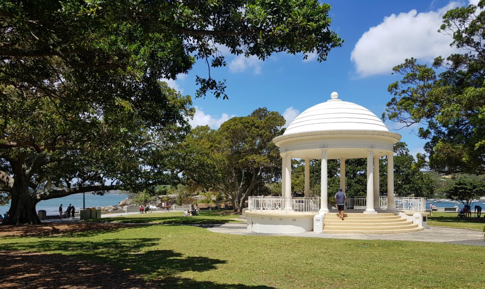
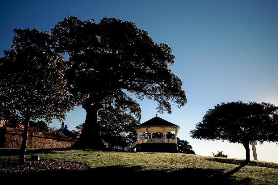
Named after a Scottish castle, Balmoral hosted an artists’ camp in the 1880s before transport improvements in the 1920s brought ferries and a tram line, introducing more Sydneysiders to its beauty. The charming 1930s rotunda remains one of my favourite features.
Today, Balmoral attracts fewer tourists than Bondi or Manly, making it ideal for visitors seeking a more authentic Sydney beach experience mixing with locals.
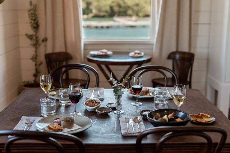
Where to eat along the way
While you’ll find cafes at Athol Hall, the main food destinations are concentrated at Chowder Bay and Balmoral Beach, offering everything from quick coffee stops to memorable dining experiences.
- Ripples at Chowder Bay serves excellent breakfast and lunch with harbour views that make any meal feel special.
- Gunners Barracks offers high tea with arguably Sydney’s best harbour views. Book ahead, especially if you want a window table.
- Burnt Orange tempts with everything from healthy breakfasts to indulgent high teas. Their diverse menu consistently makes me want to order more than I can possibly eat.
- Bottom of the Harbour Fish and Chips sits directly across from Balmoral Beach, serving some of Sydney’s best fish and chips with unbeatable water views.
- The Boathouse at Balmoral Beach specialises in upmarket salads and gourmet burgers, perfect for a post-walk meal right on the water.
How to get to Taronga Zoo Wharf (start of the walk)
By ferry (recommended): Ferries run regularly from Circular Quay to Taronga Zoo Wharf (15 minutes). From the wharf, walk along Athol Wharf Road towards the zoo’s lower entrance. The walking track begins down the ramp on the harbour side, just past the zoo gates.
By bus: Bus routes 238 or 228 connect the city to Taronga Zoo. If you arrive at the upper entrance, you’ll need to walk down to the wharf area to begin the coastal track.
How to get back from Balmoral Beach to the city or Taronga Zoo
For ferry connections back to the city, catch the 238 bus from Raglan Street to Taronga Wharf. Alternatively, direct buses run from Balmoral to the city centre.
We think this walk is the perfect addition to any Sydney itinerary, as the natural bushland here gives a great contrast to the busy city centre.
Download our Taronga to Balmoral Beach Map
Click on the markers for more information.
Google has loaded street view for this track so you can see the terrain before you head off.
Best time to do the Taronga to Balmoral walk
Early morning (8-10am): Cooler temperatures, fewer crowds, better parking
Late afternoon (3-5pm): Good for sunset at Bradley’s Head, pleasant temperatures
Avoid: Midday summer heat, rainy weather makes tracks slippery
what is the best way using bus to get to middle head fortifications from Taronga zoo jetty?
Hi Julie
There is no bus that will get you all the way between the two spots. Even if you change buses you still have at least a 12-minute walk. If you are originally travelling from the city you can take a 244 bus that goes from Wynward to the Naval Hospital on Middle Head Rd. This would be the easiest. From the Zoo, you will have to either walk to Chowder bay and take the bus from there or take a bus to Mosman and change buses on Military Road.
Is there a way to get to the wharf if you’re not going to the zoo or getting the ferry? We were going to drive from the central coast
Yes You can take a bus from the QVB or Mosman to the wharf. The 100 Route https://transportnsw.info/routes/details/sydney-buses-network/238/29238