10 Best Central Coast Walks You Must Try
Today we are sharing some fabulous Central Coast walks that will take you to some of the loveliest places in the area. As a regular visitor since I was a young child I have completed each of the walks on this list over the years. I do warn you though, if you do them all you may end up buying a house here and planning a move to the area like I have!
This page contains affiliate links. You can find our full disclosure policy here.
Located just an hour’s drive from Sydney, the Central Coast has long been a favourite getaway destination. With beautiful beaches, relaxing towns, and gorgeous national parks, the Central Coast has a surprising amount to offer.
One of the best ways to enjoy nature on the coast is to go bushwalking, and there are heaps of options. From paths that hug the coastline to well marked trails in the state forest or national parks, there are plenty of ways to get your step count up here.
Read on as we share the details you need to complete what we think are the ten best bushwalks on the Central Coast.
Have questions about things to see and do in Sydney?
Head over and join our Facebook Group and we will be happy to help.
Bouddi National Park Walk
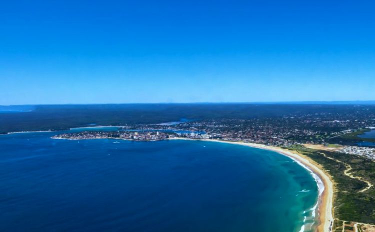
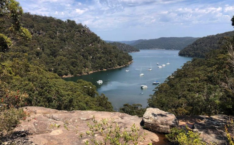
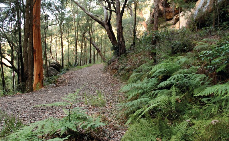
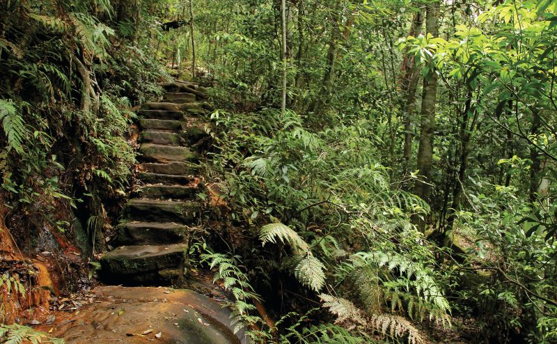
First up is Bouddi Coastal Walk, located mainly within Bouddi National Park. It’s down at the southern end of the Central Coast and runs for about 8.5 kilometres between Putty Beach and MacMasters Beach in the north. The walk takes between 3.5 and 4.5 hours but can be highly variable depending on how often you stop to admire the scenery.
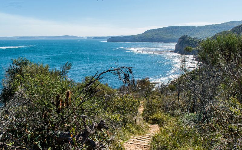
The track almost exclusively follows the coastline, running up over bluffs and down along beaches, with stretches of boardwalk and well-maintained trail.
It’s rated at Grade 3 (medium difficulty), with several climbs and descents, and some stairs as well. It’s not really hard but the first time I did the walk I was not all that fit and found it pretty challenging but I completed it again late last year as a regular gym goer and aced it! Take your time and you should be fine.
Bouddi Coastal Walk is great almost any time of year – in spring you’ll see plenty of wildflowers, in winter you might see migrating whales off the coast, and of course, in summer it’s perfect for a swim!
Where: Bouddi National Park
Length: 8.5km l Type of walk: One way.
Google map reference
Maitland Bay Track
Still, within Bouddi National Park, the Maitland Bay Track is a great Central Coast bushwalk. It’s essentially a side trail coming off the Bouddi Coastal Walk, though the trailhead can be reached separately at Killcare. Maitland Bay Track is quite short, just two kilometres return, and takes between 15 and 45 minutes each way – again, depending on how much you admire the scenery.
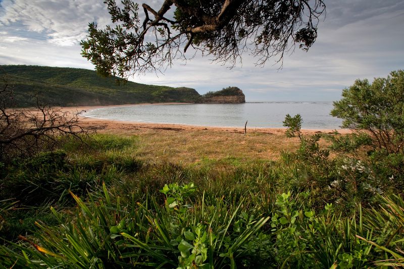
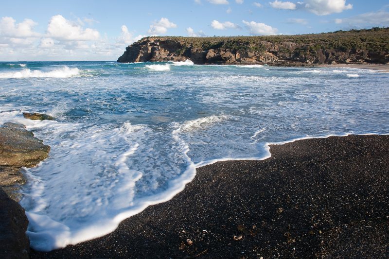
It runs downhill to the isolated Maitland Bay, through several gullies and over some sandstone outcrops as well. When you arrive at the beach, head to the eastern end and look for the wreck of the SS Maitland, which ran aground in 1898 (hence the name!).
Have a swim and enjoy the scenery, but be aware that the return journey uphill is much tougher than the descent! Maitland Bay is great in summer if you’re looking for an uncrowded place to cool off – however the beach is unpatrolled, so be careful!
Where: Bouddi National Park
Length: 2km I Type of walk: Return
Google map reference
Taking the kids? Check out our easy family bushwalks
Mooney Mooney Nature Walk
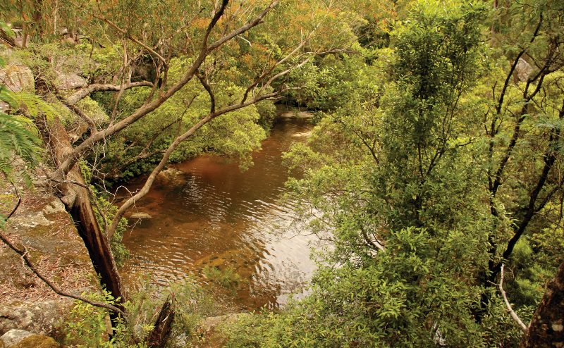
Moving away from the coast slightly, Mooney Mooney Nature Walk starts at Mooney Mooney Creek and is located inside the Brisbane Water National Park. It runs for 4.2 kilometres through rugged bushland to the Girrakool picnic area.
Expect the walk to take between 2.5 and 3.5 hours to complete, though since it’s rated as a Grade 4 bushwalk, I would not attempt this one without a reasonable degree of fitness and bushwalking experience.
If you are up to the challenge, it’s definitely worth it! There are spectacular views of the Central Coast, the Piles Creek suspension bridge, rainforest, waterfalls, rock overhangs, plenty of birdwatching opportunities, and a couple of creek crossings as well.
Because of the length and intensity of the track, unless you’re quite fit, it’s recommended to tackle in autumn or spring when the weather isn’t as hot. Also please walk with a friend!
Where: Brisbane Water National Park
Length: 4.2km l Type of walk: One way
Google map reference
Girrakool Loop Track / Girrakool Aboriginal Engravings
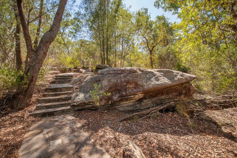
The Girrakool Loop Track (also known as the Girrakool Aboriginal Engravings Track) is also in Brisbane Water National Park. Starting and finishing at the Girrakool picnic area, this short 2-kilometre loop track should only take an hour to complete. It’s rated at Grade 3, with a few stairs, but overall isn’t too challenging.
The highlight of this walk is definitely the Girrakool Aboriginal Engravings, which are located just near the start of the walk. The main engraving is of a man, while a kangaroo and other animals are also visible nearby. Admire, but be sure not to touch the precious artworks.
Continue on the walk to enjoy patches of forest and bushland, waterfalls, lookouts, and a creek. It’s quite a pleasant spot! One you can enjoy any time of year, and one of the best walking tracks on the Central Coast.
Where: Brisbane Water National Park
Length: 2km l Type of walk: loop
Google map reference
You might also like these Coastal Walks in Sydney.
Patonga to Pearl Beach Walk
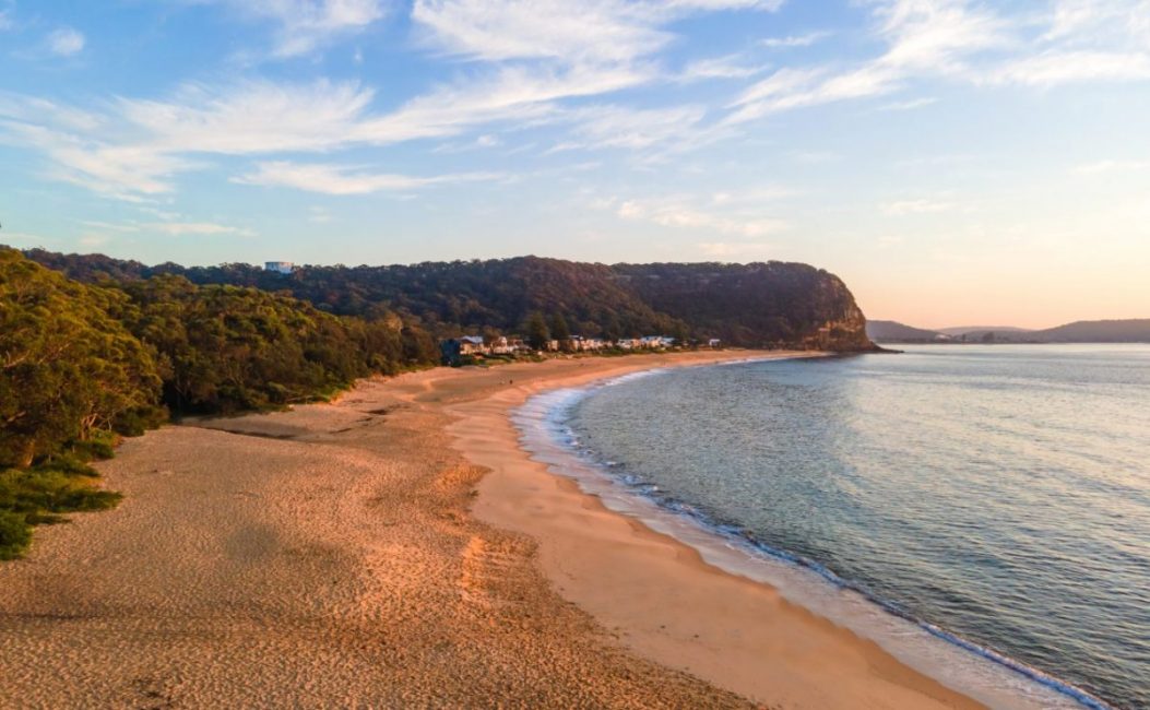
Another great walking trail on the Central Coast is the Patonga to Pearl Beach walk, also in Brisbane Water National Park. Its a beautiful walk that begins in the tiny hamlet of Patonga.
Although it’s only three kilometres in each direction, it’s rated as Grade 5 (difficult), and can take 1.5 – 2 hours in each direction, thanks mainly to the steep uphills and downhills. I recently hurt my knee so a repeat of this one is off the cards for the rest of this year. If you have any knee issues I suggest you avoid it too!
The track takes you up into the National Park, past several lookouts with fantastic views, and then back downhill to Pearl Beach. Birdwatchers should listen out for kookaburras, while brush turkeys are commonly spotted as well.
Be sure to bring your swimmers as there’s great swimming spots at both Patonga and Pearl Beach! Or if you’d prefer to wind down a different way, the Boathouse at Patonga is a great pub, and there are some excellent cafes in Pearl Beach as well.
Where: Brisbane Water National Park
Length: 3km l Type of walk: one way
Google map reference
The Coast Walking Track
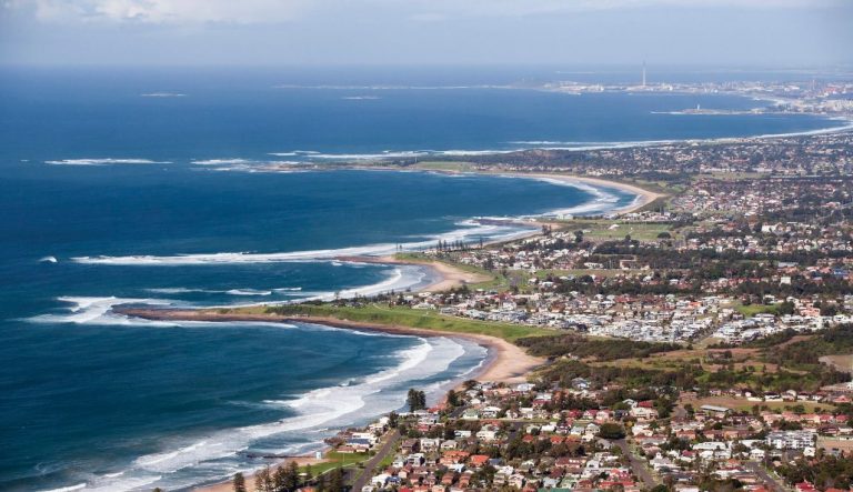
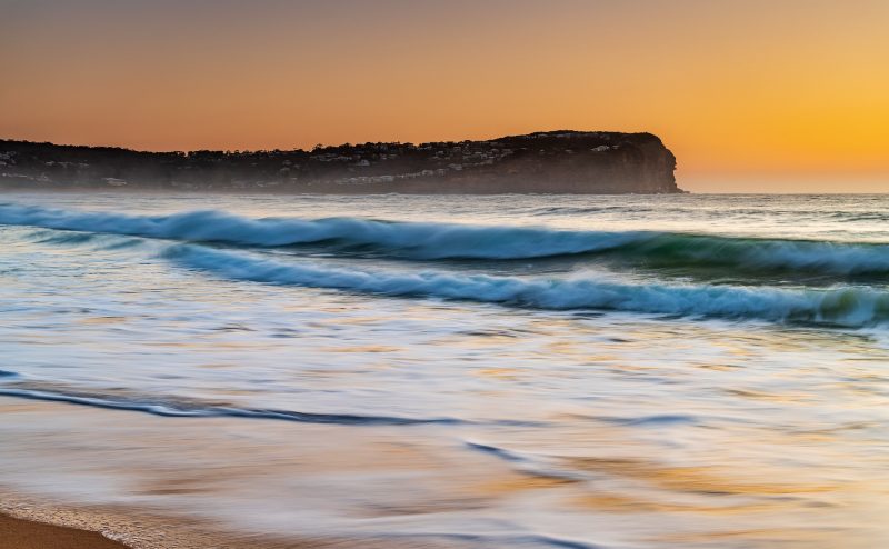
The Coast Walking Track (also known as Wyrrabalong Walk) is in Wyrrabalong National Park and runs for three kilometres between Forresters Beach and Bateau Bay. Considered as one of the most scenic walks on the Central Coast, the trail runs mainly through a small forested area along the coast.
It’s rated at Grade 3 (medium) and usually takes about 90 minutes to complete, with a few stairs for the up and downhill sections.
There are some fantastic spots along the way, with some short patches of dense forest followed by glorious ocean views. One highlight is Crackneck Lookout, with a superb view of the Pacific Ocean and several beaches up and down the coast.
Although it’s great any time of year, spring can be particularly rewarding with blooming wildflowers, and of course whale watching opportunities between May and August.
Where: Wyrrabalong National Park
Length: 3km I Type of walk: one way
Google map reference
Related: Check out our visit weekend visit to Ettalong
Coast to Lake Walk
In the scenic town of The Entrance (named for the narrow nearby entrance to Tuggerah Lakes), this 7.6-kilometre walk loops around the entire town. Showcasing both the beautiful beachfront, the busy commercial area, and the wonderful lakeside as well, following the complete loop takes about three hours at a casual stroll, or 90 minutes if you’re power walking!
The Coast to Lake Walk is divided into four sections: the boardwalk, the beach area, the residential area, and the lakefront area, so you can split it into small sections if you’d prefer. This one is suitable for the whole family.
It’s a great relaxing way to spend an afternoon, with plenty of facilities like water stations, picnic areas, lookouts and more. Dogs are allowed on the boardwalk, residential and lakefront areas, though not on the beach itself.
The beachfront section also requires crossing some rock platforms, which isn’t ideal for prams or bicycles. But overall, the Coast to Lake walk is highly recommended as one of the nicest Central Coast walks. Be sure to catch the Pelican Feeding at the boardwalk!
Where: The Entrance
Length: 7.6km l Type of walk: loop
Google map reference
5 Lands Coastal Walk
For something a little different, one of the more unusual Central Coast bushwalks is the 5 Lands Walk. An organised event that takes place in June each year, the 5 Lands Walk runs for around 10 kilometres between MacMasters Beach and Terrigal Beach, and around 20,000 people take part in the event each year.
The 5 Lands are the five beaches that are included on the trek: McMaster’s, Copacabana, Avoca, North Avoca, and finally Terrigal.
Doing the entire 10 kilometres takes most participants between 4 and 6 hours – there are several hills, steep sections and long stretches of beach, so it can challenge at times!
Exhibitions and demonstrations are set up along the way, celebrating Aboriginal culture along with Australia’s diverse ethnic makeup as well. And be sure to keep your eyes peeled for migrating whales off the coast, as the migration is a significant spiritual event for the local Darkinjung people.
Where: MacMasters Beach to Terrigal Beach
Length: 10 kilometres l Type of walk: one way
Google map reference
Lillypilly Loop Trail
Located in Wyrrabalong National Park, on a narrow spit of land between Tuggerah Lakes and the Pacific Ocean, is the beautiful Lillypilly Loop Trail. A 3.5-kilometre walk starting and finishing just near The Entrance, Lillypilly Trail is rated at Grade 3 and takes roughly 90 minutes to complete.
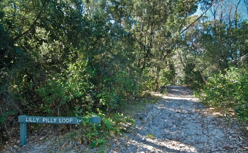
A wonderful and relaxed walk through the rainforest, the trail is surrounded by all sorts of littoral rainforest plants like cabbage tree palms.
Along with the fantastic environment, there are some spectacular views back across Tuggerah Lakes and the nearby wetlands as well. One great advantage of the Lillypilly trail is that it’s perfect for visiting in summer when the dense rainforest canopy provides plenty of shade from the sweltering sun. Just remember to bring plenty of water, and of course – a hat!
Where: Wyrrabalong National Park
Length: 3.5 kilometres l Type of walk: loop
Google map reference
Related: How many NSW Waterfalls have you visited?
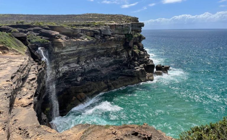
Somersby Falls Walk
Last, but certainly not least, is the Somersby Falls walking track in Brisbane Water National Park. One of the most popular picnic areas on the Central Coast, Somersby Falls is also home to one of the best Central Coast bush walks.
Clocking in at just 100 metres each way, the trail is quite steep and runs from the picnic area down to the base of the falls. It’s about 15-20 minutes each way, and along the way, you’ll pass lookouts with great views of the area.
At the base of the falls, dip your toes in the water, and of course, keep an eye out for classic Australian reptiles like goannas and water dragons. It’s a brilliant spot in the summer, with plenty of shade and the cooling mist from the waterfalls. It’s also great to visit after heavy rains when water thunders down the falls in a spectacular display.
Where: Brisbane Water National Park
Length: 100m l Type of walk: one way l Google map reference
If you decide you want to stay awhile we love the caravan parks in this area – they are some of the best holiday parks close to Sydney
Have questions about things to see and do in Sydney?
Head over and join our Facebook Group and we will be happy to help.
Would you like to see more of our content?
Click the button above and then tick the box next to SydneyExpert