Easy Blue Mountains Walks: 12 Short Walks for Families & Beginners
Looking for easy Blue Mountains walks that don’t require a full day? These 12 short walks and easy hikes are perfect for families, beginners, and anyone wanting to experience the best of the Blue Mountains without the exhaustion.
As a Sydney local who’s explored these trails for years (even with a dodgy knee), I’ve handpicked walks that deliver stunning views, waterfalls, and Aboriginal heritage sites—all within 2 hours or less. These easy bushwalks span from Glenbrook to Blackheath, with options near Katoomba, Leura, and Wentworth Falls. Whether you’re after short walks in the Blue Mountains for kids, easy walking tracks with minimal stairs, or accessible trails you can reach by train, this guide covers it all.
Each walk outline includes:
- Difficulty level and estimated time
- How to get there by public transport (because parking can be a nightmare)
- My local tips on when to visit and what to look for
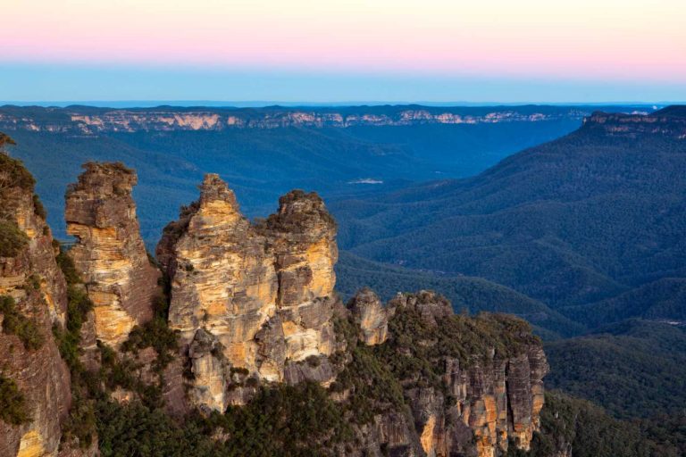
- Best photo spots Most visitors stick to the Three Sisters and miss these quieter trails.
Ready to explore the Blue Mountains beyond the tour buses? Let’s go.
What are the Best Short Walks in the Blue Mountains?
The best short walks in the Blue Mountains are:
- Three Sisters Walk, Katoomba – 45 minutes, 1km return. The most iconic easy walk with spectacular views of the famous rock formation.
- Leura Cascades – 1 hour, 1km loop. A shaded waterfall walk perfect for hot days, with minimal stairs.
- Jellybean Pool, Glenbrook – 1 hour, 2km return. Popular swimming spot ideal for families in summer.
- Govetts Leap via Fairfax Heritage Track, Blackheath – 1 hour, 1.8km return. Wheelchair-accessible with stunning valley views.
- Prince’s Rock, Wentworth Falls – 45 minutes, 1.8km return. Historic track with multiple lookout points.
All these walks take under 2 hours, require no bushwalking experience, and are accessible by public transport.
This page contains affiliate links. You can find our full disclosure policy here.
Quick Guide: Easy vs Short Blue Mountains Walks”
All walks in this guide are both easy and short, but some are easier than others. “Easy” typically means minimal stairs and suitable for most fitness levels. “Short” means under 2 hours return. I’ve included the grade rating for each walk so you can choose what suits you best.
Best Easy Blue Mountains Walks Under 2 Hours
But don’t think “easy” or “short” means “boring”. These walks will take you to breathtaking lookouts, peaceful waterfalls, and spots rich in Aboriginal history – all while avoiding the tourist crowds.
In this guide, you’ll get:
- The lowdown on each walk, including how hard it is and how long it’ll take
- My local tips on when to go and what to keep an eye out for
- Info on how to get there by public transport (because not everyone has a car and parking can be a nightmare)
- The best spots for those Instagram-worthy photos or just a quiet moment to yourself
So grab your walking shoes and a water bottle and let’s explore the Blue Mountains that most tourists never see. Trust me, these hidden gems are worth every step.
This page contains affiliate links. You can find our full disclosure policy here.
We have noted anything we think you need to know before you start walking. However, we suggest you check official advice from New South Wales National Parks and Wildlife on the day you plan to set out for the latest track conditions across the Blue Mountains National Park.

Each walk has a public transport rating for those without a car – you can reach several of these hikes from train stations or nearby bus stops. You will also find Uber and other rideshare services offered in the area. So don’t let lack of access to a car put you off hiking in the Blue Mountains.
Each listing includes a Google map reference; click these open and save to your phone for easy access later.
Easy Walks in the Lower Blue Mountains
Let’s kick things off in the Lower Blue Mountains. These towns might not get as much attention as their flashier cousins up the mountain, but that’s exactly why I love them.
They offer peaceful trails, barely a tour bus in sight, and on weekdays, you might just have the whole place to yourself. Even on summer weekends when the locals come out to play, it’s still way quieter than the tourist hotspots of Katoomba and Leura. Ready to discover these hidden gems? Let’s start with one of my favorites
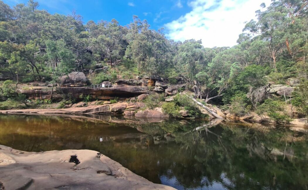
Jellybean Pool or Blue Pool Glenbrook
The essential summer walk, these two pools in Glenbrook National Park, are popular Blue Mountains swimming spots. Jellybean Pool has parking nearby, but if you want a little more seclusion, head further upstream to Blue Pool.
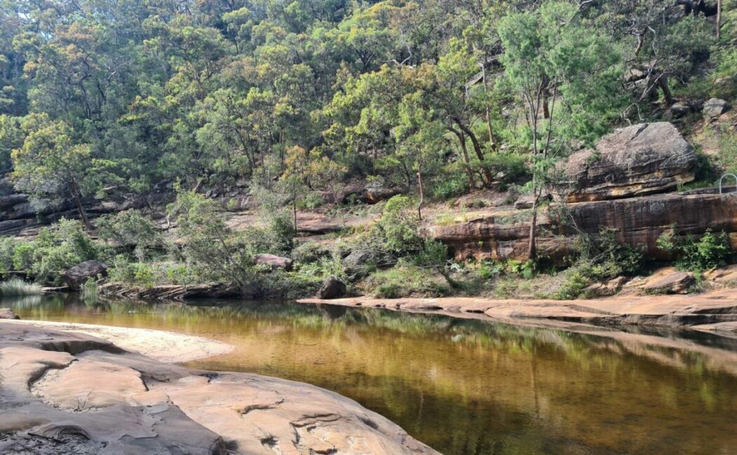
Key facts: 1 hour, easy 2km walk, grade 3 walk.
Public transport rating: Good – It is a 1.3km walk from Glenbrook Station to the track.
Google map reference: Jelly Bean Pool Track
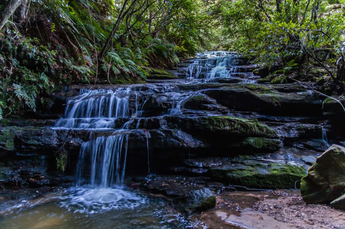
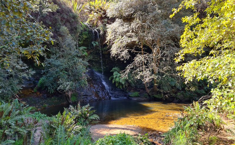
South Lawson Waterfall Walk
I have a bit of a soft spot for Lawson, having spent many childhood holidays in the area at a lovely old heritage property called Kihilla. The walks around Lawson are great for families and several, including this one, are pet friendly too. This easy bushwalk is also one of the best waterfall walks in the lower Blue Mountains.
The Lawson waterfall circuit track takes in four waterfalls; Adelina Falls, Federal Falls, Cataract Falls and Junction Falls. All are relatively small but pretty drops. Especially good after rain it’s a great walk to practice your photography skills as it’s not too far to carry your equipment. While there is usually some water here when it has been raining, you can get some awesome shots.
Lawson is also home to one of my favourite local cafes, Ben’s Cafe, a social enterprise that provides training to young people with disabilities. Before you head off on your walk and picnic at one of the falls, I suggest you pick up some refreshments here.
This waterfall track has the bonus of being dog friendly as it is outside the National Park.
Key facts: 1 hour, easy 3km walk, estimated, Grade 2-3 walk.
Public transport rating: Good – 1km walk from Lawson Station to the start of the trail.
Google map reference: South Lawson Waterfall Walk
Red Hands Cave
This walk will take you through the eucalypt forest and along Campfire Creek to the most significant Aboriginal art sites in the Blue Mountains. It is suitable for kids and makes a fun family outing. If you have some extra time, you could easily combine this with the Jellybean Pool walk.
![Aboriginal hand stencil art at Red Hands Cave in Glenbrook, Blue Mountains National Park
Sardaka (talk) 09:54, 10 September 2008 (UTC) [CC BY 3.0 (https://creativecommons.org/licenses/by/3.0)]](https://sydneyexpert.com/wp-content/uploads/2014/11/Red_Hands_Cave-wikipedia-600x377.jpg)
The hand stencils art is on a stone wall with an overhang above rather than inside an actual cave. It is protected by perspex to prevent vandalism and stop the public from touching the artwork.
Key facts: 2 hours, less than 1km. I consider this an easy walk, officially a grade 4 walk due to the short steep hills.
Public transport rating: No – nearest station is Glenbrook
Google map reference: Red Hand Caves track
Easy Walks near Wentworth Falls
Next up, Wentworth Falls, home to some say, the most spectacular waterfall in the Blue Mountains. Don’t worry, you won’t have to hike to the bottom to get amazing views. Let’s check out a couple of walks that give you plenty of bang for your buck.
Charles Darwin Walk
Many people are surprised to know that Charles Darwin walked this track in 1836 while he was on an expedition to Bathurst.
The track begins at Wilson Park and is an easy trail that offers a mainly level walk alongside Jamison Creek. The track ends near a small waterfall called Weeping Rock.
From here you can continue to one of the short walks to view Wentworth Falls (400m) or to the picnic area about 15 minutes away.
Charles Darwin walk is closed between Fletcher Street and Weeping Rock. Detours are in place to provide directions to Wentworth Falls picnic area.
Visit the official Blue Mountains Council website listing for current conditions.
Key facts: 1.5hr, easy 2.5km walk (return to station is 5km), grade 3 walk.
Public transport rating: Excellent – the walk starts metres from the station. There is a loop bus that travels between Wentworth Falls and Katoomba- the nearest stop is on Fletcher Street at the junction of Falls Road.
Google map reference: Charles Darwin Walk
Related: If you have a few days in the mountains, check out our accommodation tips.
Princes Rock Track Wentworth Falls
The Princes Rock walk is one of the oldest walking tracks in the mountains. Your efforts are rewarded with more lookouts than you can poke a stick at.
The track starts off Sir H Burrell Drive between Jamison Lookout and Wentworth Falls track.
Key facts: 30-45 minutes, easy 1.8km walk, grade 3 walk.
Public transport rating: approx 2km walk from Wentworth Falls Station – following the walk above.
Google map reference: Princes Rock walking track
Easy Walks near Leura
Ah, Leura, known for its quaint streets and stunning gardens. Leura’s also got some cracking walks up its sleeve. These trails will take you through lush fern gullies and past cascading waterfalls, all without straying too far from town. Here are a couple of my favorites.
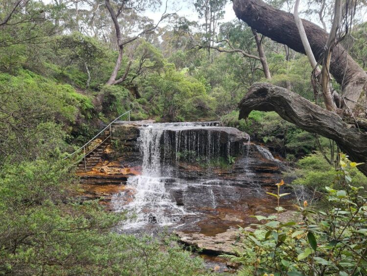
Leura Cascades Walk
The Leura Cascades is one of the most popular short walks near Leura, and for good reason. It is another excellent summer walk, especially in the middle of the day when the shade along the trail provides relief from the sun.
Passing some lovely small waterfalls, this walk is great for working on your photography skills.
The Leura Cascades Walk branches off the Prince Henry Cliff Walk and you can either retrace your steps or continue onto the round walk track and back along the cliff walk to your starting point. If you want to spend some more time here, we have a detailed guide to the walks in Leura.
Key: 1 hour, 1km, easy walk with some stairs with handrails, grade 3 walk.
Public transport rating: Not so easy – 1.6km walk from Leura Station
Google map reference: Leura Cascades track
Have questions about things to see and do in Sydney?
Head over and join our Facebook Group and we will be happy to help.
Lyrebird Dell and the Pool of Siloam
This is my favourite summer bushwalk in the mountains. It’s well shaded and if you are lucky some water around at the Pool of Siloam.
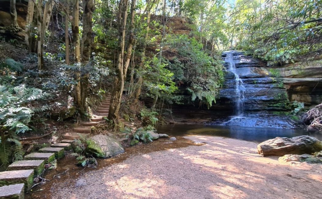
The walk continues across a small creek and passes two overhangs (cave-like) that were used by Aboriginal people as long as 12,000 years ago.
If you fancy bringing a picnic along, there are some picnic tables here.
We recently began the walk at Golf Links Lookout in Leura and walked to Gordon Falls Lookout. This is a longer walk, but worth it if you have time.
The walk from the Golf Links to the Pool of Siloam is relatively easy with a decent marked trail.
The next section to Lyrebird Dell is sometimes muddy and not as well maintained, but we had no trouble with it.
The section from Lyrebird Dell to the top of the track is not as well marked and a bit of a climb. I would probably not take small kids on this section, instead continue to Gordon Falls as even though it seems further it is easy and will take you less time.
Key facts: One hour, easy to moderate, 1.4km, grade 3 walk.
Public transport rating: Easy – the 695 bus stops nearby
Google map reference: Lyrebird Dell track
Short Walks near Katoomba
Katoomba is the heart of the Blue Mountains. Home to those famous Three Sisters and more lookouts than you can shake a stick at. But don’t worry, we’re not just going to send you to Echo Point with the tour buses. These walks will give you those postcard views, plus a few hidden gems that most visitors miss.
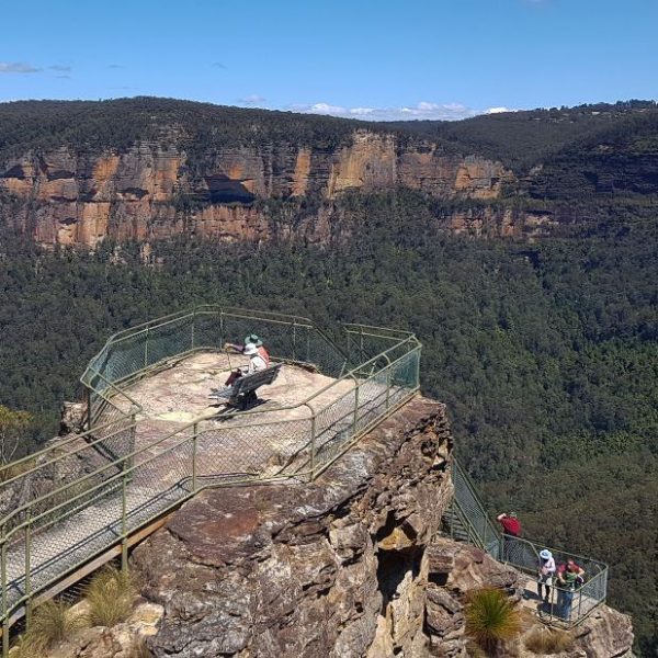
Echo Point to the Three Sisters
This easy walk, known as the Three Sisters Walk, starts at Echo Point Lookout behind the Visitor’s Centre. Most of the path is relatively new concrete, and there are several lookout points along the way.
The first one, called Oreades Lookout, is 400m in. If you have any little kids or anyone not too steady on their feet, you could stop here and return, avoiding the steep hill on the way back further down the walk.
Next up is Lady Game lookout. Then, before you know it, you reach the stairs to Honeymoon Bridge and the walk to the rock formation.
The highlight though is walking out and onto the first of the Three Sisters, but you get a great view without the last section if you cannot use stairs.
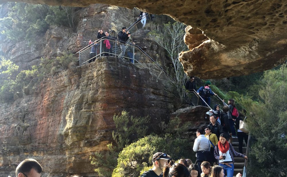
This easy Katoomba walk is the most visited track in the Blue Mountains, but it’s popular for good reason.
Key: 45 mins, 1km, easy – a little steep on the return, it is wheelchair accessible to Lady Game Lookout, grade 1 walk.
Public transport rating: Easy – bus or walk from Katoomba Station
Google map reference: Honeymoon Bridge
Katoomba Falls Round Walk
This pleasant walk begins at Scenic World and rewards with some beautiful lookouts including Vaniman’s lookout, Juliets Balcony (where you get your first glimpse of the falls) and Rainforest Lookout. The track then takes you to the base of the falls before you make your way back out via the Prince Henry Cliff Track.
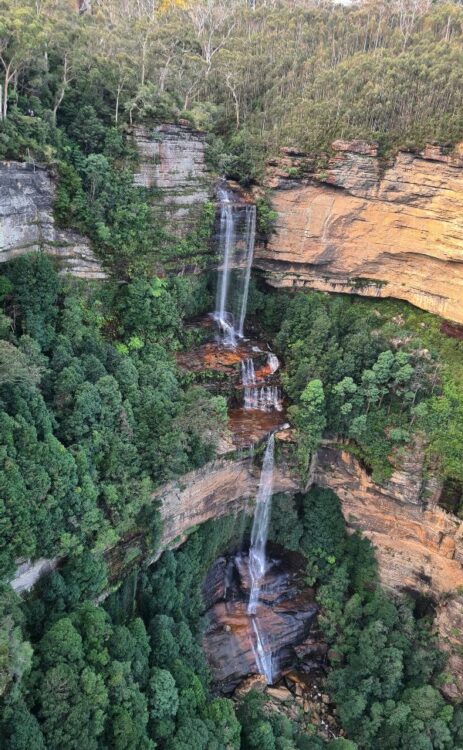
Katoomba Falls plunges 150 metres into the valley, and even in times of little or no rain, there is some water here.
Key facts: 2hrs, 4km, easy to medium graded, grade 3 walk.
Public transport rating: easy bus stop at Scenic World
Google map reference: The starting point of the Round Walk
Take this walk with a guide from Beyond the Blacktop
Easy Walks near Blackheath
Last but definitely not least, we’re heading to Blackheath. This is where the Blue Mountains really show off, with some of the most jaw-dropping lookouts you’ll ever see.
It’s a bit quieter up here, which means more elbow room for you to soak in those million-dollar views. Whether you’re after an easy stroll or something with a bit more oomph, Blackheath has got you covered.
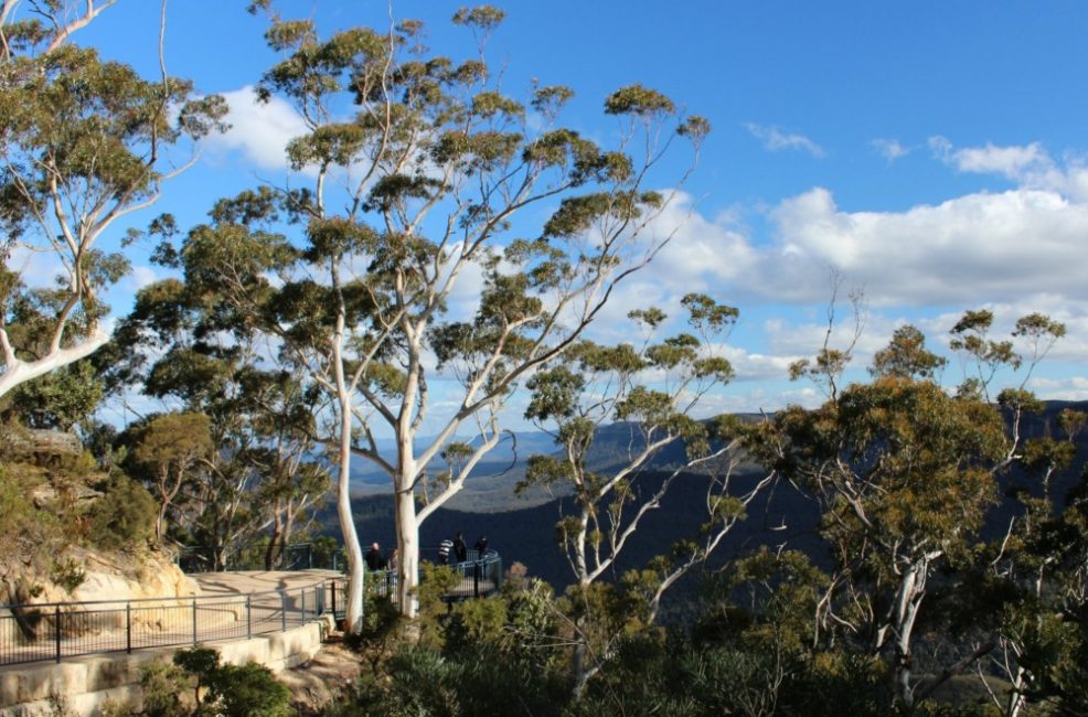
Cliff Top Walking Track
The walk is all about expansive views, bringing home the vastness of the Grose Valley. In the distance, you can see both Mt Banks and Mt Tomah.
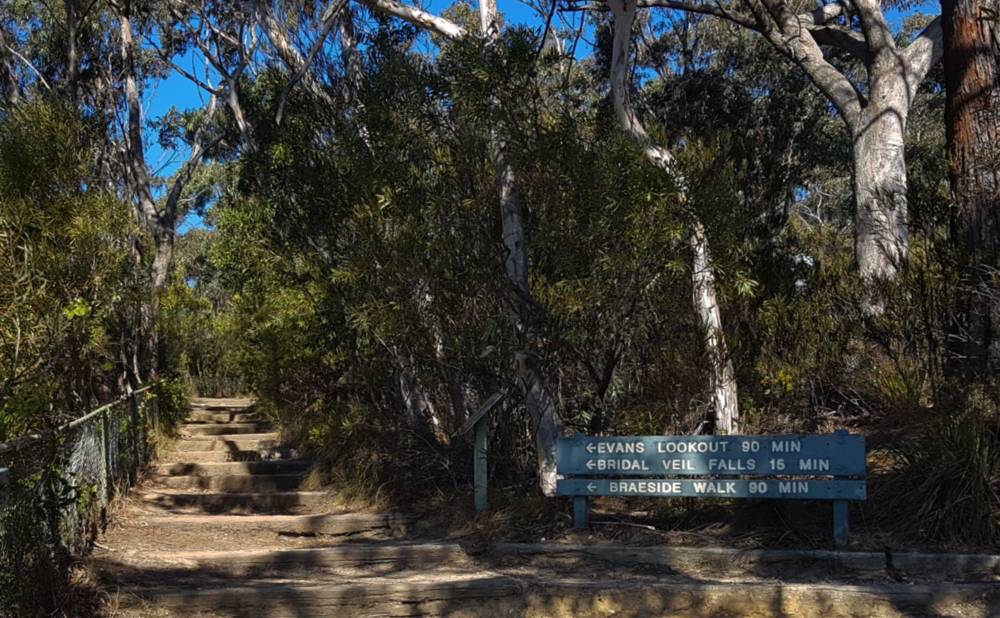
This walk is particularly pretty in spring when wildflowers bloom along the path.
Key: 90 minutes each way, 3km one way, grade 3 walk.
Public transport rating: Not so easy, long walk or taxi ride from Blackheath, there is a bus that stops near the Heritage Centre
Google map reference: Evans Lookout track
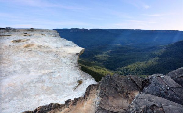
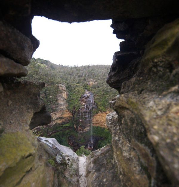
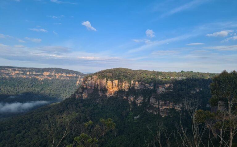
Govetts Leap Walk via Fairfax Heritage Track
The Fairfax Heritage Track, the easiest of the walks in Blackheath, is wheelchair friendly too. The track passes two great viewpoints, George Phillips Lookout and Govetts Leap Lookout.
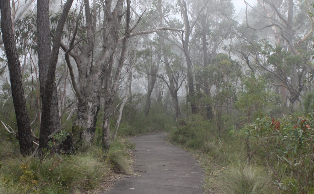
The path, a flat tar surface, is lined with native grass trees and scribbly gums and is pleasant, even on warm days. Our last few visits have been very foggy, as shown by the image above, but that only adds to the atmosphere. There are picnic benches at the George Phillips Lookout.
Key facts: 1 hour, 1.8km one way, retrace your steps or return via the road which is a short, easy and pram friendly grade 1 walk.
Public transport rating: The local bus (698) stops near the visitors centre.
Google map reference: Starting point – the Blue Mountains Heritage Centre
Pulpit Rock Walking Track
Pulpit walking track is closed from Cripps lookout to Pulpit Rock lookout.
Still considered an easy walk, but not quite as easy as some of the earlier tracks, mainly because of the stairs. There are lots of stairs! The 270-degree view extends to Mount Hay, and Mount Banks, and back to Evans’ lookout.
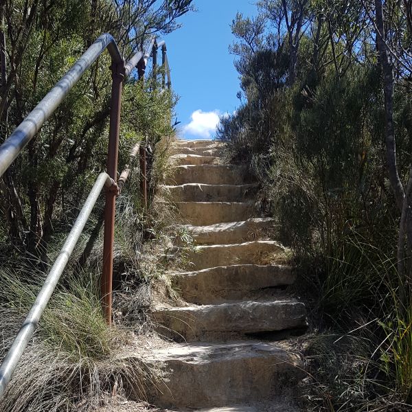
The views here are in our top three in the Blue Mountains. Even though the bushland here was affected by the fires of the summer of 2020, regrowth is well underway and it is looking pretty good.
Key: 45 minutes including a brief rest before you walk back up! Less than 1km, Easy – as long as you can do steps, there are lots, grade 3 walk.
Public transport rating: Very difficult (5km walk – rideshare best)
Google map reference: Pulpit Rock Track
If you want a more challenging walk in Blackheath, check out the Grand Canyon Walk, either by yourself or with a guide.
How to know if this walk is right for you
Before you lace up your hiking boots, let’s make sure you’re picking the right track for your fitness level and experience. The last thing we want is for you to bite off more than you can chew and end up with sore legs (or worse, a rescue helicopter!).
Here’s a quick guide to understanding the grades used by the NSW National Parks:
- Grade 1. No bushwalking experience required, some are wheelchair accessible.
- Grade 2. No bushwalking experience required, some steps and stairs
- Grade 3. Suitable for most ages and fitness levels, can include lots of steps and stairs.
- Grade 4. Bushwalking experience recommended, good levels of fitness required
- Grade 5. Very experienced bushwalkers with specialised skills, including navigation and emergency first aid.
I usually stick with Grade 3, unless I am walking with others who have more experience than I do.
How Long are the Short Blue Mountains Walks?
Short Blue Mountains walks range from 30 minutes to 2 hours return:
- 30-45 minutes: Three Sisters Walk, Prince’s Rock, Pulpit Rock
- 1 hour: Jellybean Pool, Leura Cascades, Govetts Leap, Lyrebird Dell
- 1.5-2 hours: Charles Darwin Walk, South Lawson Waterfall, Katoomba Falls Round Walk
Most short walks in the Blue Mountains are between 1-2km in distance and graded as easy (Grade 1-3), making them suitable for families and beginners.
Which walks in the Blue Mountains are wheelchair accessible?
Good news for our friends using wheels – whether that’s a wheelchair, mobility scooter, or even a pram! The Blue Mountains might be known for rugged terrain, but there are still some gorgeous spots you can explore without breaking a sweat (or a wheel).
Here’s a list of walks that are smooth sailing for everyone:
- Leura Cascades – This walk is partially accessible. The path to the view of the upper cascades has an accessible lookout.
- Three Sister’s Walk at Katoomba – This track is rated accessible. However, it is a little steep in spots and users may need assistance.
- Katoomba Falls / Cliff View Lookout is an easy 30-minute return walk from Katoomba Falls Park.
- The Gully Walk in Katoomba is an easy 1km return walk from Gates Ave
- Fairfax Heritage Track is an easy flat 2km walk on a good surface, with a view of Grose Valley.
Dog friendly walks in the blue mountains
This is a pretty short list – but luckily there are a couple of dog-friendly Blue Mountains walks. The Lower Blue Mountains near Lawson and Hazelbrook and the upper mountains around Mount Victoria are your best bet, mainly in the areas not included in the National Parks.
- South Lawson Waterfall Walk is a 3km circuit walk.
- Horseshoe Falls Reserve, Hazelbrook – 2km return walk
- Mount Piddington in Blackheath is an almost 8km challenging walk.
- Minnehaha Falls Reserve, Katoomba is 2.6km with some ladders where you will have to carry your furry friend.
- Wentworth Falls Lake is a perfect place for lazy dogs!
Frequently Asked Questions About Blue Mountains Walks
Time to Hit the Trails!
So there you have it – 12 easy Blue Mountains walks that pack a punch without taking up your whole day. Whether you’re a Sydney local looking for a quick escape or a visitor wanting to see the best of the mountains in limited time, these walks have got you covered.
Remember, the Blue Mountains are more than just the Three Sisters and Scenic World. By venturing onto these lesser-known trails, you’ll get to experience the true beauty of the area – without the crowds or the sore legs the next day.
So what are you waiting for? Lace up those shoes, pack some snacks, and hit the trails.
P.S. Don’t forget to check the weather and track conditions before you go. And if you discover a hidden gem I’ve missed, leave us a comment – I’m always up for a new adventure!
very nice thanks so much for sharing
This is one location in Australia that I have always wanted to visit, never quiet made it. So many amazing beautiful walks that would be worth the effort regardless of walk grade. Spectacular photos.