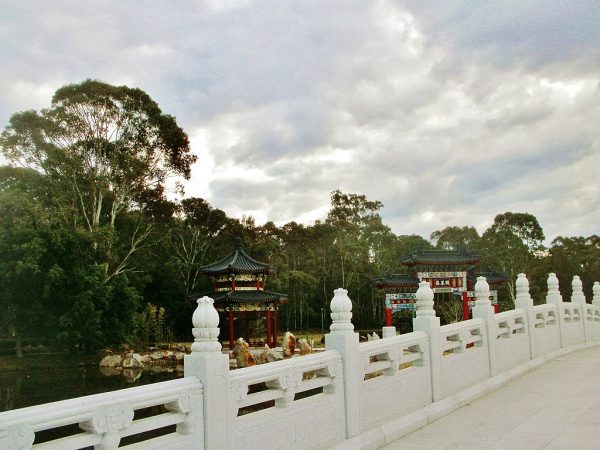
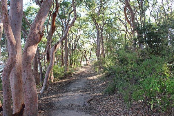
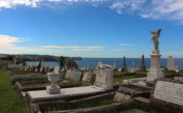
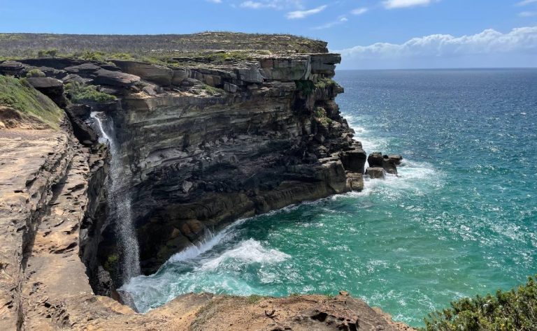
Find Walks in Your LGA in Sydney: 60+ great ideas
Are you trying to find some interesting walks in Sydney? If you are looking for new walking tracks to explore well we have plenty to share. We pulled this together back in 2021 when we were all walking close to home and have given it a quick dust off because we really should keep up those good daily exercise habits we developed in 2020-2021 when going for a walk was all we were allowed to do! So here you go walks available across Sydney organised by Local Government Areas.
Combining our personal favourites with those of the members in our FB group, we present this list. If we have missed your top choice, please pop over to the group and share it. We all need more walks in our lives.
Facts about Sydney’s Local Government Areas
What a learning experience this turned out to be! I am now an expert on the LGAs of Sydney. After hours of research, we have discovered:
- In terms of area, Hunters Hill is the smallest Local Government Area in Sydney at 5.7km
- Hornsby is the largest, covering 455km
- Canterbury Bankstown has the largest number of residents, and Hunters Hill the lowest.
- Northern Beaches LGA has the longest coastline
- Kur-ring-gai LGA has three national parks within its boundaries
- Sydney has a Great North Walk, a Great West Walk and a Great South Walk in on the way.
- There are 30 LGA’s in Sydney – which means this is a really long page 😉
Walks in Bayside LGA
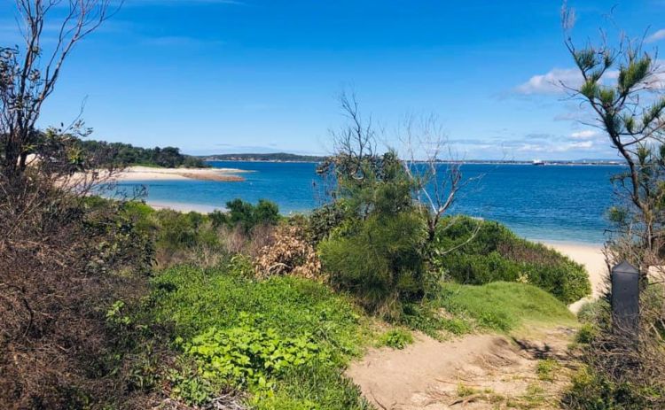
If you live in Bayside, you are lucky, you have the shores of Botany Bay in your backyard. From Port Botany to San Souci, there is plenty of waterfront land to stroll along.
Two popular walks in Bayside are:
- Lady Robinson Beach walk – a 6km flat dog friendly stroll along the shore of Botany Bay
- Bardwell Valley Parklands – a 2.5km walk between Bexley Aquatic Centre and Bardwell Valley. You can continue to Tempe (5.5km total). The path is dog-friendly and suitable for kids. A feature is the Prime Ministers Walk – a series of plaques that, although a little worse for wear, celebrate some of our best known leaders.
Find your own walks using the map of the Bayside LGA or exploring the Bayside Council website.
Walks in Blacktown LGA
Blacktown residents also score well with half of the vast Western Sydney Parklands in their backyard.
- Nurragingy Reserve – Part of the parklands, there are several short tracks here, or you can attempt the main loop, which is just under 7km long. Don’t miss the Chinese gates for a travel photo moment.
- The Great West Walk – Why not tackle part of this 65km walk that stretches from Parramatta to the foot of the Blue Mountains. The section from Seven Hills Station to Wainmatta Regional Park falls within this LGA.
Check out the local council resources on walking in Blacktown, and this map of the Blacktown LGA can help you find your own walking opportunities.
Walks in Burwood LGA
Burwood is one of the smaller LGAs in Sydney, and it does not have many walking tracks, but it does have some lovely parks. You can string a few together to form a walk along the Cooks River.
- Cooks River Walk – Start in Flockhart Park and make your way along the river to Walsh Ave Reserve – you will wander along Walsh street past houses briefly before heading into the reserve.
- Burwood Town Centre Walk – Allows you to explore the historic buildings in Burwood and learn more about the suburb’s heritage.
Check the Burwood Council website for more ideas or create your own walking route using this map of the Burwood LGA.
Camden LGA Walks
Historic Camden town centre itself makes a lovely place to stroll, but for a longer walk, you are spoilt for options in this part of Sydney.
Two we think you should check out are:
- The Loop Trail at William Howe Regional Park – an easy 2.5km dog friendly loop walk
- Miss Llewella Davies Pioneers Walkway – Part of the Camden Town Farm Loop (6.4km) – this walkway offers three sections; two of these are wheelchair accessible. No dogs are allowed on this walkway.
Also included in the Camden LGA is The Australian Botanic Garden at Mount Annan, an excellent spot for an early morning walk.
Check out the map of Camden LGA to plan your own walks, or check out the council website which has many walking guides for the region, they are guaranteed to keep you busy for quite a while.
Walks in Campbelltown
There are loads of great parks in the Campbelltown LGA and even a National Park, so you will have plenty of space to explore if you live in this area.
Simmo’s Beach is a popular spot but likely to be quite busy on weekends so perhaps save it for a weekday morning.
Two standouts are:
Minerva Pool walking track – A popular 2.4km long walk in Dhrawal National Park. While the picnic areas and toilets are closed, you can access the track for exercise. Just be sure to turn up with an empty bladder! If you are doing this walk in warm weather, please note the pool itself is a sacred women’s place for the Dhrawal people, and only women should swim here.
Freres Crossing – a peaceful 2km return bushwalk along the Georges River. The walk is dog and kid-friendly. Nearby Keith Longhurst Reserve can be added if you want a longer walk.
Want more? Check this LGA map for Campbelltown or find the walks recommended by the Council on their website they also have a handy search tool to help you find areas you can walk your dog!
Walks in Canada Bay LGA
With kilometres of foreshore along the Parramatta River, the residents of Canada Bay are pretty lucky! The council lists walks and a couple of apps on their website for exploring Rhodes.
The Bay run is the best-known walk in the area but it’s split between Canada Bay and the Inner West LGAs, so we have decided on highlighting two others we love.
- Kokoda Track Memorial Walkway – This 800m path (1.6km return) between Rhodes Station and Concord Hospital is a living memorial to New Guinean Campaign of World War II. Plaques with detailed information line the path of this rainforest walk on Brays Bay.
- Hen & Chicken Bay Foreshore Walk – If you are looking for a bit more distance, this full walk is 8km each way, but if you are not up to a long hike, just choose part and tackle it over a few attempts. The walk is dog friendly and includes crossing several off-leash parks so your pooch will love it!
If you don’t live in Canada Bay, stick this on your to-do list for when we are allowed out exploring again.
Want more? Check out the Canada Bay Council website, which has details of a number of audio-guided walks you can download. There is an LGA map of Canada Bay to find your own walks.
Canterbury Bankstown Walks
The Cooks River runs through the Canterbury Bankstown LGA, and the paths along its shoreline are popular with locals. If you find they are a little busy, head to the southern part of the area and check out these two walks.
- Deepwater Park to Kelso Beach – an easy flat 1.5km walk along the banks of the Georges River.
- The Ridge Walk – this 1.6km track in Georges River National Park is rated grade 4, so it’s a great choice if you are looking for a bit of a challenge.
Georges River National Park is best known for its picnic grounds, but there is plenty of space to walk by the water or one of the two official tracks if your fitness is good.
Find more walks in the Canterbury Bankstown area by exploring the LGA map or the Canterbury Bankstown Council website.
Walks in Cumberland LGA
Best known for the beautiful Auburn Botanic Garden, Cumberland Council has three beautiful parks within its boundaries but not many long walking tracks.
During restrictions, the following are your best choices:
- Holroyd Gardens Nature Reserve – Explore the historic brickworks and the duck pond on paved walking trails in the park.
- The Warali Wali Track – is a 4.7 km (one way) or a 9.4 km (return) long track that runs along the Prospect Creek Corridor between Cumberland and Fairfield Council. Be sure to check the site before you head off and stay within your LGA during lockdowns. Along the route, there are four Aboriginal artworks – two in each council area.
‘Warali Wali’ is the Darug word for possum.
Find more walks in Cumberland on the council website or make up some of your own using this map of the Cumberland LGA.
Fairfield LGA Walks
Bordering Cumberland above, there can be some confusion on which walks are in which LGA especially when doing the Warali Wali Trail, which runs right along the border, depending on which side of the creek you are on!
Two walks that are squarely inside the Fairfield LGA are:
- The Pimelea Loop – an easy 1.6km paved walk in Western Sydney Parklands suitable for prams and wheelchairs
- The Sugarloaf Loop – a 2km loop walk with gentle hills – not suitable for prams or wheelchairs.
Fairfield has had some of the biggest challenges of this lockdown so finding some safe uncrowded green space to get some exercise is even more important. Mayor Frank Carbone has done a sterling job keeping the community updated and even sharing the best walks in Fairfield city on his Facebook page.
Check out this map of the Fairfield LGA or visit the Fairfield Council website for more ideas.
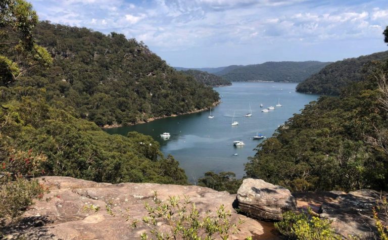
Walks in Georges River LGA
Georges River’s eastern border is just a couple of blocks from Botany Bay, a discovery that saw my regular morning walk sidelined. However, its southern border gives residents the Georges River and plenty of waterfront parkland.
- Carss Park Bush Loop Walk – on the eastern edge of the boundary, this 2.7km loop around Kogarah Bay is one option, if you prefer you can just stroll the length of the waterfront and back along a flat paved path.
- Lime Kiln Bay Circuit Walk – The path feels miles away from the nearby suburban Sydney. The track is about 2.5km long and traverses mangroves and wetlands.
There is also a long walking track in Oatley Park that is also a great place to stretch your legs.
The Georges River Council website lists a number of other walks to enjoy. You can also use this LGA map to find your own opportunities.
Walks in Hornsby LGA
The largest LGA in Sydney in terms of area, Hornsby boasts one national park, Berowra Valley National Park, and two bushland reserves.
- Blue Gum walk – 4km loop walk listed as grade three, so perhaps best for those with at least average fitness. There are two shorter sections if you want something more leisurely.
- Place of Winds interpretive trail – A short steep walk (1.2km each way) with plenty of stairs to get the heart pumping. There is not great signage here, so it’s a great place to practice your navigational skills!
The Hornsby LGA map will help you find more walks inside the area, and there are more on the council website.
Hunters Hill LGA Walks
Following the expansive green space on offer Hornsby, we have Hunter’s Hill, Sydney’s smallest LGA. To get your steps in here you will need to include some of the areas pretty streets.
- Woolwich Wharf or Huntleys Pt Wharf – About 6km depending on the route you choose. This is part of the Parramatta River Walk.
- Great North Walk – Boronia Park to Buffalo Creek Reserve is a 2.9km stretch along the Lane Cove River.
I also suggest you check out Gladesville Hospital, where you can explore the grounds and historic buildings.
Use this map of the Hunters Hill LGA to create your own walking opportunities or take a look at the official council website for ideas.
Inner West Walks
This large LGA stretches from Balmain to Marrickville and takes in the southern side of the famous Bay Run as well as harbour views from the Balmain Peninsula.
However, you can have just as much fun here checking out the areas abundant street art; in fact, the council have shared three maps on their website to help you find the work they have sponsored.
- Tom Uren Trail – Discover the best views in Balmain on this 3.1km walk. The suburban walk includes some stairs and steep hills but take your time, and it’s no problem for anyone with average fitness.
- Cooks River Walk – The 4km stretch along the Cooks River from Tempe Station to Wardell Road Dulwich Hill
- Ballast Point Park – I love this park in Birchgrove, a number of tracks lead your though the area and there is a killer staircase to get the blood pumping. The park is dog friendly.
Find more walking opportunities in the inner west on this LGA map or check out the maps the Inner West council has shared.
Walks in Kur-ring-gai LGA
Kur-ring-gai has its famous National Park, home to some of the best lookouts in the city but there are two more parks within the boundary, so you will not want for green space and lockdown walking opportunities.
- Kur-ring-gai Wildflower Garden – has walks ranging from 10 min strolls, great for little legs to the 3km Mueller Track.
- Two Creeks Track – This 7.5km walk offers views of Middle Harbour and ends at the historic Roseville Bridge.
- Sphinx Memorial to Bobbin Head Track – a challenging 10km loop track that is perfect for those days when you just need to get out and burn up some energy
Not sure of the boundaries of the Kur-ring-gai? Check this LGA map or find the walks recommended by the Council on their website.
Lane Cove LGA Walks
Confusingly perhaps no part of Lane Cove National Park is actually in Lane Cove LGA, they do, however, have the Lane Cove Bushland Park.
- Greenwich Point to Greenwich Reserve – you can cover 1.8km on a stroll along the Greenwich Peninsula with views of the Lane Cove River.
- Lane Cove Bushland Park to Gore Creek – 3.5km walk past Lillypilly waterfall, a small but pretty fall best viewed after some rain.
Find more walking opportunities using this Lane Cove LGA map
Walks in Liverpool LGA
Chipping Norton Lakes is one of the most popular open spaces in the Liverpool LGA. Two other parks, Bents Basin Reserve and Kemps Creek Reserve, also offer walking opportunities
- Lake Moore Walk – a flat 3km dog-friendly walk that is suitable for everyone
- Voyager Point Trail – a 4.8km trail adjacent to the Georges River starts at Voyager Park.
We have not explored many walks here so if you know a great lockdown walk in Liverpool please let us know so we can add them.
Hunt down your one walks using this Liverpool LGA map or the council website.
Mosman LGA Walks
Taking in the southern side of Middle Harbour Mosman is blessed with some pretty fabulous views whether you take one of the harbourside tracks or venture through the suburban streets of Beauty Point. Plenty of hills too, for getting the heart rate up!
Two popular walks that we never tire of are
- Athol Bay to Balmoral – This walk is 6km in total, but you could choose to finish at Chowder Bay and retrace your steps from back to Athol Bay for an 8km trek.
- Foreshore Track from Mosman Bay to Athol Cove – Start this walk at the end of Curraghbeena Rd, where the Foreshore Track begins and make you way to the lower gates of Taronga Zoo.
Create your own walks using this Mosman LGA map or Mosman Council has an app Mosman Walks for both Android and iPhone.
Walks in North Sydney LGA
The North Sydney LGA features seven peninsulas jutting down into Sydney Harbour. Along with Wendy’s not-so-secret garden, which frankly might get a little busy at times, you can easily just get your daily lockdown walk just strolling from Blues Point to Mary Booth Reserve. The northern part of the region fronts Middle Harbour at Primrose Park.
- Cremorne Point walk – Starting from Cremorne Reserve, make your way to Old Cremorne Wharf. From here, you can either double back or take the track to Bromley Road.
- Berry Island – a dog friendly 750m loop walk on Sydney Harbour with signage highlighting the Aboriginal significance of the area.
- Primrose Park – view the tiny but pretty Willoughby Falls and some significant Aboriginal sites on this 30-minute walk.
Explore the North Sydney LGA map and find your own walks. North Sydney Council also has some easy-to-follow guides on their website.
Northern Beaches Walks
A huge LGA that features dozens of beaches from Manly all the way to Palm Beach, you will not run out of walking paths if you call the Northern Beaches home. Much of Garigal National Park and almost all of Kur-ring-gai National Parks fall within the borders of Northern Beaches LGA.
Given the size of the area, we included one walk in the south, one in the north, and one on the western side of the boundaries.
- North Head Walk – Over 10km of tracks and trails on offer and views to the city. Pop in an explore the Q Station while you are there.
- Curl Curl Lagoon – 3km dog friendly loop walk that is relatively flat.
- Magazine Track – A grade three 3.4km track around Bantry Bay and Flat Rock Beach in Killarney Heights
Find your own walks using a map of this LGA or check the Northern Beaches council website for more walking tracks.
Walks in Parramatta LGA
The Parramatta River provides some of the best opportunities for walking in the Parramatta LGA; however, there are a few other gems in areas like Winston Hills, where a string of parks carve out quite a decent walk.
- Parramatta River Walk – with the new Escarpment Boardwalk just south of the Parramatta Weir, you can now walk to the boundary of the LGA of Parramatta a total of 9km along the waterway.
- Lake Parramatta Walks – Five walks to choose from, including the Arrunga Bardo Garden Bushtucker talk.
- Parramatta Park – Lots of easy walking tracks and a couple of hills for when you want to push yourself.
Find your own walks using a map of the Parramatta LGA or on the council website; there are 15 more walks to try.
Walks in Penrith LGA
At the foot of the Blue Mountains, the Penrith LGA has many great outdoor spaces including, Penrith Lakes Regional Park, Agnes Banks Nature Reserve, Castlereagh Nature Reserve, Mulgoa Nature Reserve, Werrington Lakes Flora & Fauna Reserve. These parks all offer lockdown walk opportunities.
Start by completing these walks:
- Bridge to Bridge Walk – Start at Weir Reserve and walk from Penrith Valley Bridge to the Nepean River Bridge, a 9.7km loop.
- Castlereagh Nature Reserve Walk – This 8.7km loop is a flat walk on a roughly surfaced track that offers the chance to spot Kangaroos at the right time of day.
- International Regatta Centre Loop – 5km loop – super flat and easy if perhaps a little dull if no one is training in the waters.
Find your own walks using a map of this LGA or on the council website.
Randwick LGA Walks
Taking in the suburbs of Little Bay, Matraville, Maroubra, Coogee and Randwick, the residents of this LGA also won the jackpot with Centennial Park in their locale.
Two walks every local should tick off:
- Malabar Headland – the Western Escarpment Track which connects South Malabar, is only 1km making it perfect for when you just need some fresh air and a break from the suburbs. Enjoy 3600 views over Botany Bay.
- Cape Banks Walk – a 7km return walk starts at Congwong Beach and takes you out to Henry Head before looping back to your starting point.
Want more? Explore the coastal walk on the Randwick Council website of check the LGA Map
Walks in Ryde LGA
The southern boundary of the Ryde LGA travels along the Parramatta River getting residents plenty of waterfront tracks to stroll.
Two walks in Ryde we enjoy are:
- Meadowbank Wharf to Kissing Point Walk – 2km wheelchair accessible walk along the foreshore of the Parramatta River.
- Sugarloaf Point and Lookout – a nice easy 1.4km loop that you can extend by exploring the Field of Mars Reserve. Note Boronia Park and Buffalo Creek Reserve are outside this LGA, but we recommend exploring them when not in lockdown.
Want more? Explore other walks on the Ryde Council website of check the LGA Map of Ryde.
Strathfield LGA Walks
Strathfield is a small LGA with no large open spaces for long walks, however; there are a number of parks.
- Cooks River Stroll – Starting at Ford Park, you can get a good 1.4km walk each way along the river.
- Strathfield Park – Along with a few fabulous playgrounds, you can stretch your legs on the paths in this lovely park.
You might also like to explore the streets of Strathfield as Joanne did; there is plenty to see if you slow down.
Want more? Explore other walks on the Strathfield Council website of check the LGA Map of Strathfield.
Walks in Sutherland LGA
If you are lucky enough to live in this LGA, you have at your disposal an abundance of green space, 11km of beaches and countless walking tracks. The council has a great blog with an entire section of walks. The choice of Lockdown walks in the Sutherland Shire are among the best in Sydney.
- Woronora River Bridge Walk – This 1.5km walk takes you across the bridge with a lookout along the way. Suitable for most wheelchair users.
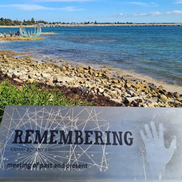
- Cooks Landing to Cape Solander – This walk in Kamay National Park is 2.5km each way and is suitable for the whole family but a great walk for younger kids.
- Burnum Burnum Sanctuary – This 2.7km loop walk at Bonnet Bay is a mix of flat trails with steep sections. Dogs on leash are welcome.
You can find loads more walks on the Sutherland Council website or check the map of Sutherland LGA
Sydney City LGA Walks
You could easily get your daily exercise just by wandering around the Royal Botanic Garden, but there are a couple of walks that will allow you to rack up the steps, and enjoy the harbour at the same time. Sydney Park and Moore Park also offer large areas of open space.
- Woolloomooloo to Darling Harbour – Also known as the Sydney Harbour Foreshore walk, an 11km walk that takes in the best parts of the city.
- Glebe Foreshore Walk – continues from the walk above; just cross under the bridge via the Fishmarket. The track runs for 4km ending at the Tramsheds.
- Sydney Park – Down on the areas southern boundary, Sydney Park is a fabulous place with wetlands and fantastic birdlife. There are numerous paths, and you can easily do a 2.5km loop walking diagonally across the parkland.
Use the map of Sydney City LGA to find your own walks or check the extensive list of walks on the council website.
Walks in The Hills LGA
Another large region, the Hills Shire, includes Cattai National Park, Cumberland State Forest, Maroota Ridge State Conservation Area, Bidjigal Reserve, Bella Vista Farm Park.
- Cumberland State Forest – Forest Walk is a peaceful 1.8km walk with lots of steps to get the heart pumping.
- West Pennant Hills Waterfall Walk – a 3.4km child-friendly walk that is not too challenging and suitable for most people. It includes a small waterfall in Bidjigal Reserve.
Find more walk in the Hills LGA map or visit the council website for more ideas.
Walks in Waverley LGA
Bondi to Coogee is the best-known walk in Sydney, let alone Waverley, and as far as lockdown walks go this one is very busy, so we decided to give you two more choices.
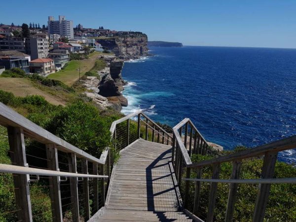
- Waverley Cliff Walk aka Federation Cliff Walk – Start at Dover Heights Park and you can walk to Christison Park before you reach the boundary of Waverley LGA.
- Waverley Walks – history and cultural walks overlooking the Pacific Ocean.
Explore more of the Waverley LGA using this map or check the council website for ideas.
Willoughby LGA Walks
An almost secret part of Sydney, Willoughby takes in the leafy suburbs of Middle Harbour. With some of the most beautiful and perhaps least known walks in all of Sydney, if you are a Willoughby resident, you are one lucky Sydneysider! We really struggled to choose just two.
- Harold Reid Foreshore Walking Track -a 5km walk that welcomes dogs on a leash
- Sailors Bay Track – This walk in Castlecrag is only 1.5km return but offers lovely views of Coachwood forest, sandstone and a hidden waterfall. Dogs prohibited.
Find more works using the Willoughby LGA map or visit the council website for a fantastic list of walks in the area and an app for both Android and iPhone.
Walks in Woollahra LGA
There are so many pretty walks here, you are unlikely to tire of the views on your daily walks in Woollahra, from leafy streets with beautiful homes to a stroll out to Hornby Lighthouse.
- Hermitage Foreshore Walk – 2 km each way; this walk is inside Sydney Harbour National Park, so sadly no dogs allowed. Along the way, there are a number of pretty beaches and postcard views like the one above.
- Cooper Park Trail – Tree ferns, a moss-covered bridge, and a feeling of escape can be found deep in the heart of suburban Woollarhra just minutes from Edgecliff Station. The trail is a 3.2km loop has some inclines and stairs but nothing too intimidating. Dogs on a leash are welcomed.
Want more walks? The council website has a list of options or you can find your own on the Woollahra LGA map.
Other places to find good walks include:
- Your local council website – some councils have great content for residents and visitors to help them enjoy the recreation opportunities nearby. We have linked them below.
- The All Trails App – a website and an app available for both Android and Apple
- Facebook groups – there’s Hiking and Camping NSW, Sydney Bush Walks.
- Reddit threads – The Sydney Reddit threads
- Instagram – Follow hashtags like #Sydneywalks
- The WildWalks website – Plenty of good ideas on Wildwalks
- Travel with Joanne – Discover some of the 85 suburbs that Jo has explored. Each with a map and points of interest.
Have questions about things to see and do in Sydney?
Head over and join our Facebook Group and we will be happy to help.
Anything in Canterbury Bankstown other than that two suggestions. I’m in Bankstown and it is too far with restrictions. Anyone who has access to lovely outdoor areas spare a thought for us who don’t have anything other than the local kids parks that are packed. I’m not an outdoorsy person but even I need some outdoor time in a beautiful place. Lockdown definately isn’t equal.
Hi Suraiya I am sorry but I am not really familiar with Bankstown and those are the two I have done. I suggest you ask in our Facebook group where hopefully a local can respond. https://www.facebook.com/groups/Sydneyexpert
Walks in Cumberland LGA
The link in the “Find more walks in Cumberland on the council website” actually goes to Canterbury-Bankstown not Cumberland.
Can I please ask that this be updated
Thanks
Thanks for letting us know! All fixed 🙂