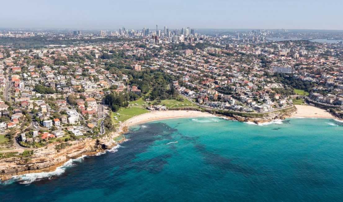
12 Sydney Coastal Walks: From Easy Family Routes to Challenging Hikes
Sydney’s coastal walks range from easy family-friendly boardwalks to challenging multi-day wilderness treks. Whether you want a quick 4km walk with ocean views, a whale‑watching adventure, or a serious backcountry hike, this guide covers the routes worth walking — organised by difficulty and region.
Each walk includes practical details: distance, public transport access, accessibility info, and what makes it unique. You’ll find everything from the iconic Bondi to Coogee route to hidden coastal gems most visitors never discover.
This page contains affiliate links. Please see our disclosure policy for details.
Quick Answer: Best Coastal Walks in Sydney
- Easiest & Most Accessible: Brighton to Sans Souci (4km), one of Sydney’s flattest coastal promenades
- Most Famous: Bondi to Coogee (6km)
- Best for Families: Coogee to Maroubra (5km)
- Best for Whale Watching: Cape Bailey Track (6km, June-August)
- Most Dramatic: Royal National Park Coast Track (26km)
Sydney’s Best Coastal Walks by Difficulty
Looking for easy coastal walks suitable for families, beginners, or accessibility needs? These routes keep gradients gentle and facilities close by.
Looking for easy coastal walks suitable for families and accessibility needs?
- Bondi to Coogee Walk (6km) – Perfect for first-time visitors
- Brighton to Sans Souci Walk (4km) – Fully wheelchair accessible with cafés
- Coogee Clifftop Walk – Boardwalk section ideal for prams
Moderate coastal walks for regular walkers:
These moderate coastal walks suit regular walkers comfortable with some stairs, uneven paths, and a bit more distance
- Federation Cliff Walk (5km) – Harbour and ocean views
- Long Reef Walk (3km) – Excellent for snorkelling and photography
- Collaroy to Manly Walk (11.5km) – Northern Beaches alternative to Bondi
Challenging walks for experienced hikers:
These challenging routes are best for experienced walkers who enjoy longer distances, rougher terrain, and exposed coastal sections.
- Cape Bailey Track (6km one way) – Best for whale watching
- Royal National Park Coast Track (26km) – Multi-day wilderness experience
Getting Started with Sydney’s Coastal Walks
Sydney’s coastal walks offer a perfect introduction to the city’s outdoor lifestyle. With most routes accessible by public transport and well-maintained facilities throughout, these paths let you explore Sydney’s dramatic coastline while getting some exercise. Each walk reveals a different side of the city, from bustling beach suburbs to peaceful nature reserves.
Before You Go: Essential Safety Tips for Coastal Walking
Stay safe: Never turn your back on the ocean, check weather and tide conditions, and bring plenty of water. Coastal paths often offer little shade, so pack a hat, sunscreen and sun‑protective clothing.
Emergency: Call 000 for emergencies and let someone know your planned route and expected return time.
What information do I need to choose the right coastal walk?
To help you choose the perfect walk for your day out, we’ve included all the practical details you need:
- How long is the walk?
- Can you reach the walk by public transport?
- Is this walk suitable for prams or wheelchairs?
- Can I take my dog on this walk?
- Are there good places to eat/drink nearby?
- Are there toilets and shaded spots along or near the route?
Rather than ranking these walks (they’re all brilliant for different reasons), we’ve organised them by area to help you find something close to where you are or want to explore. Within each area, walks move from the most accessible family‑friendly options to the more challenging adventures.
If you are looking for walks like the Spit Bridge to Manly, Bradley’s Head, South Head to the Hornby Lighthouse or North Head Sanctuary, check out our Sydney Harbour walks page.
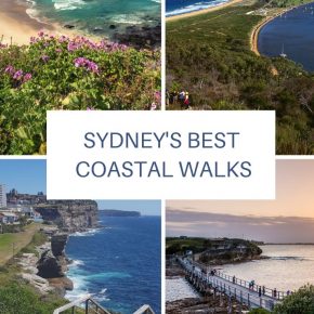
Eastern Suburbs: Coastal Walks in Sydney’s Most Famous Beach Areas
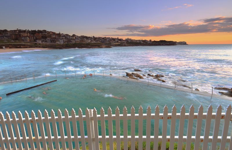
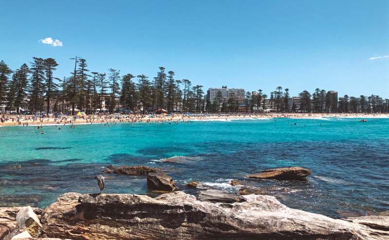
Bondi to Coogee Coastal Walk (6km)
Is the Bondi to Coogee walk worth the crowds? Absolutely. This 6km coastal path links some of Sydney’s most famous beaches and is one of the most iconic walks in Australia.
If you are short on time or energy, you can walk the Bondi to Bronte section instead and still experience dramatic headlands, ocean pools, and classic Eastern Suburbs beach culture.
What makes the Bondi to Coogee walk special?
- Pass five gorgeous ocean beaches: Tamarama (dramatic and compact), Bronte (family-friendly with great facilities), Clovelly (sheltered bay perfect for snorkelling), and Coogee (village atmosphere with excellent cafes)
- Swim at Bronte Baths: This heritage ocean pool carved into the rocks offers protected swimming with crashing waves just metres away
- Stroll past (or through) the historic Waverley Cemetery: one of Australia’s most scenic cemeteries, where many notable Australians are buried overlooking the ocean
- Snorkel beautiful Gordon’s Bay. A protected underwater nature trail with diverse marine life, perfect for beginner snorkeller
Before you head out, check out our very detailed guide to the Bondi to Coogee walk, where we have answered every question we have ever received about walking this track.
Insider tip: There is a natural bogey hole at Bronte only visible when the tide is right – approx. halfway between high and low tide.
Practical information for the Bondi to Coogee walk:
- Public transport rating: super easy, buses at every beach; however, Bondi Beach has the most frequent services.
- Wheel Friendly: not really, prams possibly, but with plenty of lifting
- BBQs: Yes, at Bronte and Clovelly
- Dog-friendly: Yes, on a leash on the paths, but not on the beach.
- Playground: Yes
- Nearby dining: You will be spoilt for choice at Coogee, Bronte and Bondi!
Shorter option: If you prefer a short walk, start at Bondi and finish at Bronte.
Federation Cliff Walk (5km)
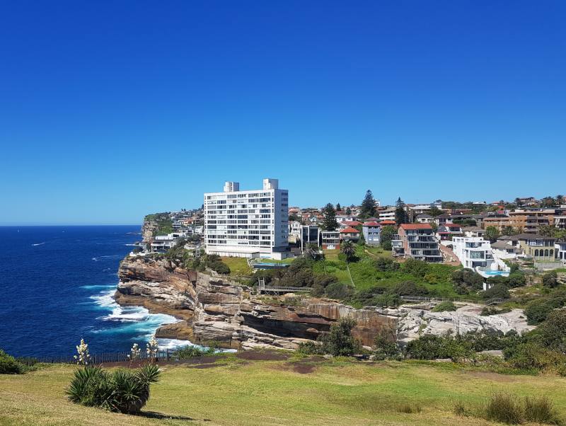
Want to explore Sydney’s rugged eastern coastline away from the main beaches? The Federation Cliff Walk, also known as the Waverley Cliff Walk or the Dover Heights walk, links Bondi to Watsons Bay and gives you outstanding views of the sheer sandstone cliffs that protect Sydney Harbour.
The official starting point is Dover Heights, but you can also begin from North Bondi by following the coastline and ducking in and out of back streets whenever you reach a fence.
What will I see on the Federation Cliff Walk?
- Fantastic Sydney Harbour views from Dudley Page Reserve – One of the best vantage points to see the harbour’s full sweep, from the Heads to the city skyline
- Dramatic sandstone cliffs and old staircase at Diamond Head – Historic stone steps carved into the cliff face, a reminder of early efforts to access this rugged coastline.
- Historic Macquarie Lighthouse – Australia’s first lighthouse, built in 1818 and still guiding ships today
From Dover Heights, the route is straightforward and outlined in our detailed Federation Cliff Walk guide. Alternatively, you can take the 380 bus from Bondito the start of the walk.
Insider tip: Resist the urge to leave the track at Diamond Bay and go under the cliffs for a “magic” Insta shot; the cliff is fenced off because it is unstable and dangerous
Practical information for the Federation Cliff Walk
- Distance: 5km one way.
- Public transport: Super easy. Regular buses (380 and 333) run between Bondi and Watsons Bay, with stops near the start and finish.
- Wheel friendly: Partially. You can avoid the Diamond Bay stairs by using the back streets, but there are still uneven sections and gradients.
- BBQs: No.
- Dog‑friendly: Yes, on a leash in signed areas.
- Playgrounds: Yes. A small playground at Weonga Reserve and a larger one at Robertson Park in Watsons Bay.
- Nearby dining: Limited options en route, but plenty of cafés, fish and chips and pubs at Watsons Bay.
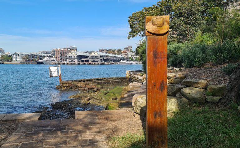
The Hermitage Foreshore Track in Sydney Harbour National Park at Rose Bay is another great Eastern Suburbs option.
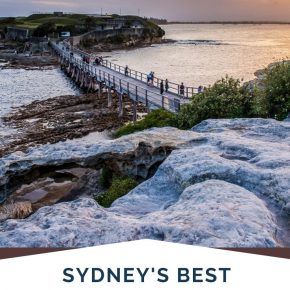
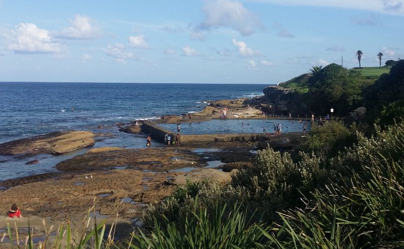
Coogee to Maroubra Coastal Walk (5km)
Want the Bondi to Coogee experience without the crowds? If you loved the Bondi to Coogee walk but want something quieter, the Coogee to Maroubra walk is your next move.
It offers everything that makes the first walk special – stunning ocean views, historic rock pools and great swimming spots – but with a fraction of the crowds.
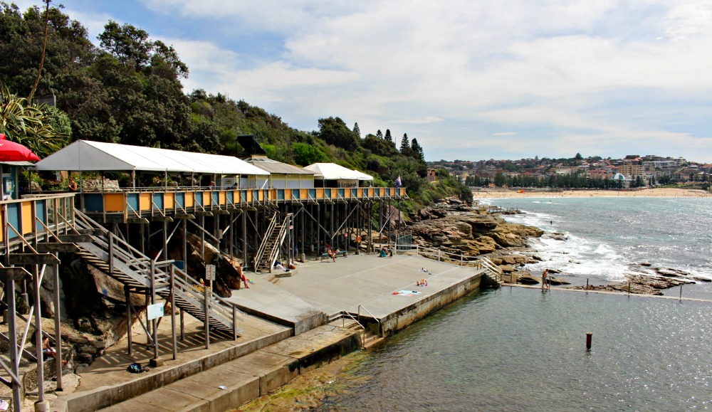
The first section, known as the Coogee Clifftop Walk, is particularly brilliant for families. A boardwalk with a slight incline makes it accessible for wheelchair users and those with prams.
The rest of the walk rewards you with beautiful rock pools and panoramic views of Sydney’s coastline, perfect for walkers who prefer less crowded paths.
Sydney’s Unique swimming spots along the walk
Sydney’s unique swimming spots along the walk:
- McIvers Ladies Baths – Australia’s last remaining women-only ocean baths, a piece of swimming history still in use today
- Wylies Baths – A heritage-listed ocean pool carved into the rocks in 1907, perfect for a sheltered swim
- Ivor Rowe rock pool – A natural hallow tidal pool that’s ideal for kids and nervous swimmers
- Mahon rock pool – My favourite sunrise spot in Sydney, with dramatic rock formations and fewer crowds
All these rock pools are hard to resist, so I suggest you pack your swimmers!
Practical information for the Coogee to Maroubra walk
- Distance: 5km one way.
- Public transport: Easy bus access from the city or Bondi Junction to both Coogee and Maroubra.
- Wheel friendly: The Coogee Clifftop boardwalk is very suitable for prams and many wheelchair users, but the full route includes some uneven and sloped sections.
- BBQs: Yes, at Coogee.
- Dog‑friendly: Yes, on a leash on the path, but not on the beaches.
- Playgrounds: Yes, several along the route, especially around Coogee.
- Nearby dining: Plenty of cafés and takeaway options at both Coogee and Maroubra.
More info on parks along this route: Randwick Council website
Have you taken the Taronga Zoo to Balmoral Beach walk yet? It’s a stunning harbour option.
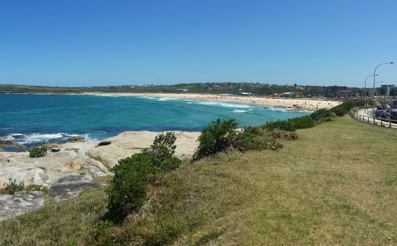
Maroubra to Malabar Coastal Walk (3.6km)
Where can I find spectacular coastal views without tourist crowds? This is one of Sydney’s best‑kept secrets among coastal walks; if you want stunning scenery without the crowds, this is your answer.
Beginning at Maroubra, one of Australia’s official National Surfing Reserves, the walk takes you from thundering surf (Maroubra means “like thunder” in the local Aboriginal language) to the quieter beauty of Malabar Beach.
If you decide to swim, stay between the flags; currents can be strong here.
The walk begins on the northern side of Maroubra Beach. The first section, from Mistral Point along Maroubra Beach to South Maroubra, is just under 2.5km and is wheelchair and pram friendly.
Why visit the Maroubra to Malabar walk?
- Great views of Botany Bay – Watch ships coming and going from Port Botany while enjoying sweeping coastal views
- Family-friendly rock pool at Malabar – A sheltered natural ocean pool with wheelchair access and calm waters perfect for kids
- Whale watching spot in season (June-October) – Elevated headlands offer excellent whale spotting opportunities during migration season
- Picturesque rocky bays – Dramatic rock formations and secluded coves that feel worlds away from the city
The next section to Malabar begins in Arthur Byrne Reserve at South Maroubra and connects to Pioneers Park in Malabar. This 1.15km Western Escarpment Walking Track links with the 3.7km Boora Point Walking Track, and you can also walk a 4km loop around Malabar Headland.
Your final destination is Malabar Beach, a hidden gem that many locals would prefer to keep to themselves. The rock pool here is sheltered and has a wheelchair ramp into the water; the bay is more rocky than sandy but beautifully scenic.
Practical information for the Maroubra to Malabar walk
- Distance: 3.6km (with additional options via the Western Escarpment and Boora Point tracks).
- Public transport: Easy bus access from the city to Maroubra and Malabar.
- Wheel friendly: Only the first section along Maroubra Beach; the headland section includes many stairs and uneven terrain.
- BBQs: Available at Maroubra and in nearby parks; facilities are more limited at Malabar.
- Dog‑friendly: Dogs are permitted on leash on the first section to South Maroubra but not on the beaches or in some headland areas (check local signage).
- Playgrounds: Yes, several around Maroubra and in nearby reserves.
- Nearby dining: Plenty at Maroubra and a handful of options at Malabar.
Download the detailed map (PDF) if you would like to give this walk a try.
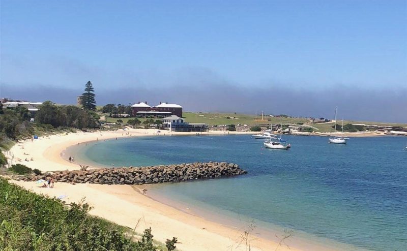
La Perouse to Yarra Bay Coastal Walk (2.8km)
Looking for Australian Aboriginal culture alongside your coastal walk? If you want a route with genuine cultural significance, La Perouse offers something very different from the typical beach‑to‑beach experience.
This is where you can walk through thousands of years of continuous Aboriginal connection to Country alongside early European settlement history. The Kameygal people know this land as Guriwal, and many Aboriginal families still live and work in the area today.
As the Dictionary of Sydney notes, “La Perouse is the one area of Sydney with which Aboriginal people have had an unbroken connection for over 7,500 years.”
This walk is a relatively short and easy one, great for younger kids who may tire on others on this list. From La Perouse, head to the playground, and you will see a walking track heading into the bush. This is the Guriwal Bush Tucker Track, it features signage highlighting traditional foods and medicines.
Once you reach Yarra Bay, return to La Perouse via the beach.
What cultural and historical experiences await?
- Bare Island Fort – A 19th-century fortress connected to the mainland by a narrow causeway, open for guided tours on the last Sunday of each month
- Signposted Bush Tucker Track – Learn about traditional Aboriginal foods and medicines along the Guriwal Bush Tucker Track between Yarra Bay and Frenchman’s Bay
- Weekend snake shows in Cann Park – Educational reptile displays that kids love, usually held on weekends
Insider tip: The Blak Markets, which sell fabulous indigenous goods, are held at La Perouse regularly. Check the dates here.
Practical information for the La Perouse to Yarra Bay
- Distance: 2.8km, generally flat and easy.
- Public transport: Easy bus access, including services from the city and Bondi Junction (such as the 390X/394 series; always check current routes).
- Wheel friendly: Yes, for much of the path around La Perouse headland and along the shared coastal path; some beach sections are on sand.
- BBQs: Yes, at Frenchman’s Bay and Yarra Bay picnic areas.
- Dog‑friendly: Dogs are permitted on‑leash in some reserves but not on the beaches themselves; check local signage.
- Playground: Yes, at Frenchman’s Bay and nearby reserves.
- Nearby dining: Several cafés and takeaway options at La Perouse, plus the Yarra Bay Sailing Club overlooking the bay.
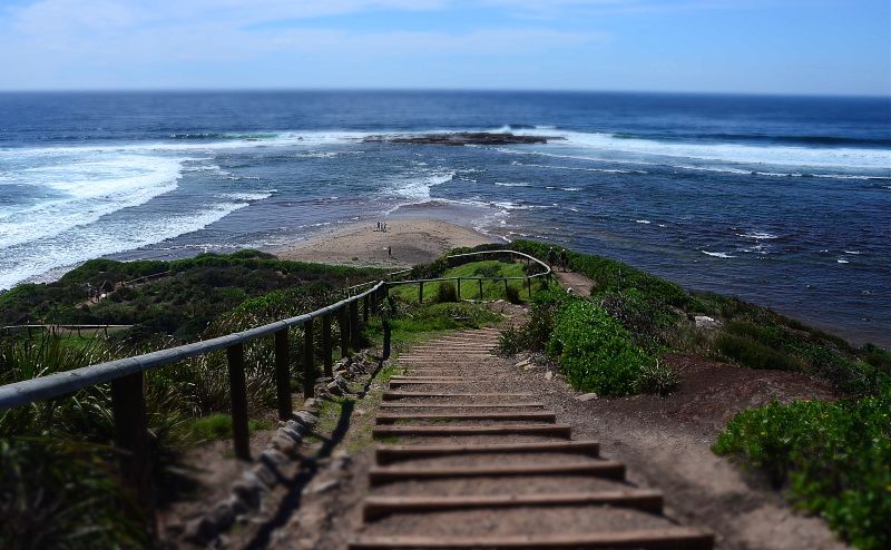
Cape Bailey Track (6km)
Where’s the best land‑based whale watching in Sydney? If you are serious about whale watching, this is your walk. The Kamay Botany Bay National Park at Kurnell offers some of the best land‑based whale‑watching opportunities in Sydney. This 6km track takes you from Cape Solander to the historic Cape Bailey Lighthouse, following the same clifftop route that migrating whales use as their highway between feeding and breeding grounds.
The walk is relatively flat but completely exposed. There is no shade and no facilities along the track, so come prepared with water, sun protection and sturdy footwear. What you lose in comfort, you gain in spectacular unobstructed ocean views and the very real possibility of witnessing one of nature’s greatest shows.
What makes Cape Bailey special for whale watchers?
- Prime whale watching position – One of Sydney’s best whale-watching spots, particularly between June-August when humpbacks pass close to shore
- Cape Bailey Lighthouse – A historic lighthouse marking the southern entrance to Botany Bay, still operational today
- Unobstructed ocean views – 180-degree views across the Pacific with no buildings or trees to block your sightlines
- Kamay Botany Bay National Park – Walk through the protected bushland where Captain Cook first landed in 1770
Insider tip: This is one of Sydney’s best whale-watching spots, so a visit between June-August is usually well rewarded.
Practical information for the Cape Bailey Track
- Distance: 6km one way (various shorter and longer options are possible along the clifftops).
- Public transport: Train to Cronulla, then the 987 bus service to Kurnell (check current routes and timetables).
- Wheel friendly: No. For an accessible alternative in the same park, check out the nearby Burrawang walk around the visitor centre.
- BBQs: Yes, in designated picnic areas in Kamay Botany Bay National Park (not on the exposed clifftop section).
- Dog‑friendly: No; dogs are not permitted in the national park.
- Playground: No on the track itself; playgrounds are in nearby suburbs, not along the walk.
- Nearby dining: Cook at Kurnell and a handful of cafés in Kurnell village.
- Park fees: Day‑use vehicle fee applies in the Kurnell area; pay at the machines near the entrance.
Coastal Walks on Sydney’s Northern Beaches
These tracks offer a more relaxed alternative to the eastern suburbs, with longer stretches of sand, excellent surf breaks, and a laid-back beach culture that feels distinctly different from the city beaches.
Long Reef Headland Coastal Walk (3km)
Want to combine coastal walking with snorkelling? The Long Reef walk offers something unique among Sydney coastal walks: a striking contrast between manicured golf course greens and wild ocean coastline around a protected aquatic reserve.
This 3km circuit around the headland is particularly popular with photographers and nature lovers, thanks to its tidal platforms, birdlife and the hang gliders who launch from the cliffs above.
What makes Long Reef special for underwater enthusiasts?
- Long Reef Aquatic Reserve – Sydney’s most accessible snorkelling spot, with protected waters and diverse marine life including blue groper and sea dragons
- Whale watching between April and November – The elevated headland position offers excellent whale spotting opportunities during migration season
- Watching the hang gliders and paragliders – Regular aerial displays as adventure seekers launch from the cliff tops, creating spectacular photo opportunities
Local tip: Visit at low tide and wander down the stairs at the base of the headline.
If you can get up early, you will find you are often rewarded with a magnificent sunrise.
Long Reef Headland Coastal Walk
- Distance: About 3km for the main loop around the headland, with options to extend via Dee Why or Collaroy.
- Public transport: Easy; buses stop within about 100m of the reserve. Parking is metered around the golf club and beach.
- Wheel friendly: Not fully wheelchair accessible. Prams are generally fine, with a few sections where you may need to lift or detour; the first section from the car park up to the main lookout is the easiest.
- BBQs: Available at nearby Long Reef Beach and adjoining parks.
- Dog‑friendly: Yes on a leash in signed areas; there is an off‑leash dog exercise area nearby on the beach (check local signage).
- Playground: Yes, in nearby reserves.
- Nearby dining: Long Reef Golf Club’s bistro and cafés in Collaroy and Dee Why.
More details are on the Northern Beaches Council website.
The 11.5km Collaroy to Manly walk takes you through six distinct beach communities, each with its own character and charm. Starting from the laid-back family atmosphere of Collaroy Beach and finishing at the bustling promenade of Manly, you’ll pass through Fisherman’s Beach, Long Reef, Dee Why, Curl Curl Beach, and Freshwater Beach.
Collaroy to Manly Coastal Walk (11.5km)
Looking for a longer coastal walk with fewer crowds?
Looking for a longer coastal walk with fewer crowds? Think of this as the Northern Beaches answer to the famous Bondi to Coogee walk – except it is longer, less crowded and arguably more spectacular.
The 11.5km Collaroy to Manly walk takes you through six distinct beach communities, each with its own character. Starting from the laid‑back family atmosphere of Collaroy Beach and finishing at the bustling promenade of Manly, you pass Fisherman’s Beach, Long Reef, Dee Why, Curl Curl and Freshwater along the way.
What makes this walk special is the variety: dramatic headland views, sheltered family beaches, snorkelling at Long Reef and the historic charm of Freshwater, where Duke Kahanamoku introduced surfing to Australia.
What will you discover on this Northern Beaches journey?
- Walk along six surf beaches – Experience the distinct character of each Northern Beaches community, from family-friendly Collaroy to the surf culture of Freshwater.
- Long Reef Aquatic Reserve – Detour to one of Sydney’s most accessible snorkelling and rock‑platform areas with rich marine life.
- Statue of Duke Kahanamoku – Pay homage to the Hawaiian legend who demonstrated surfboard riding at Freshwater Beach in 1914, helping to introduce surfing to Australia.
It’s a long walk, but it’s full of rewards and a perfect walk if you are looking for something to contrast the world-famous Bondi Beach walk.
Insider tip: For the best views, do this walk north to south
Practical information: Collaroy to Manly walk
- Distance: About 11.5km one way, with options to break it into shorter sections around major beaches.
- Public transport: Easy bus access from Manly to Collaroy to start the walk; buses also connect most beaches along the route.
- Wheel friendly: No. Some sections are paved, but there are stairs, uneven paths and stretches on sand.
- BBQs: Freshwater and several other beach parks along the way have BBQs and picnic areas.
- Dog‑friendly: Dogs on leash are permitted on some shared paths and reserves, but not on the ocean beaches themselves; check local signage.
- Playgrounds: Yes, multiple playgrounds at beaches and parks along the route.
- Nearby dining: Lots of cafés, kiosks and restaurants at each main beach, with plenty of choice at Manly at the finish.
Insider tip: For the best cumulative views and slightly easier logistics back to the city, many walkers prefer to go north to south, finishing at Manly.
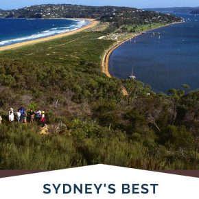
Palm Beach and Barrenjoey Lighthouse Walk (2.3km one way)
Want to spot Home and Away filming while walking? At Sydney’s northernmost tip, Palm Beach offers something very different from the city’s other coastal walks – a taste of exclusive beachside living where many of Sydney’s wealthy retreat for weekends and holidays.
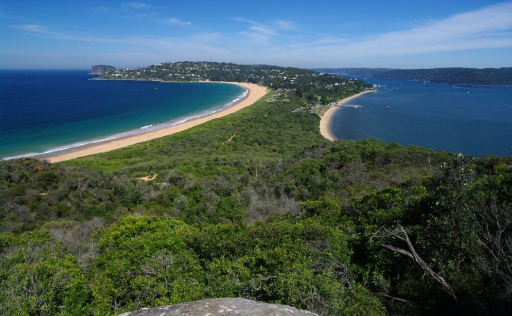
While plenty of visitors come hoping to spot the Home and Away cast around the lighthouse and surf club, the real appeal is the stunning dual‑aspect views: the Pacific Ocean on one side and the calm waters of Pittwater on the other.
What makes Palm Beach worth the journey north?
- Barrenjoey Lighthouse walk. Climb to the historic 1881 lighthouse for sweeping views over both the ocean and Pittwater – one of Sydney’s most spectacular vantage points.
- Home and Away filming locations. See the outdoor sets used in Australia’s longest‑running soap, particularly active on some weekdays.
- Calm Pittwater shores. Gentle, sheltered waters ideal for families, with options for swimming, kayaking and stand‑up paddleboarding.
- Ferry connections. From Palm Beach Wharf, take a scenic ferry to Ettalong on the Central Coast or to The Basin campground in Ku‑ring‑gai Chase National Park.
Insider tip: Weekdays give you a better chance of seeing filming, but they also mean fewer day‑trip crowds on the lighthouse track.
Insider tip: Weekdays are your best option if you want to see the Home and Away gang recording.
Practical information: Palm Beach and Barrenjoey walk
- Distance: Around 2.3km one way, depending on your route to and from the lighthouse and wharf.
- Public transport: Super easy in principle but a long ride; buses from the city and North Shore run to Palm Beach (about 41km from the CBD), and parking is metered in peak areas.
- Wheel friendly: No. The lighthouse track is steep and includes steps and uneven surfaces.
- BBQs: Governor Phillip Park at Palm Beach has multiple picnic and BBQ areas.
- Dog‑friendly: No dogs on the beach, in the national park or on the lighthouse track; dog‑walking is possible at nearby Careel Bay.
- Playgrounds: Yes, in Governor Phillip Park and nearby reserves.
- Nearby dining: Several options from fish and chips and casual kiosks to cafés and restaurants near the wharf and along the main strip.
Coastal Walks in Sydney Southern suburbs
Brighton‑Le‑Sands to Sans Souci Coastal Walk (4km)
Need a completely accessible coastal walk for the whole family? If you are looking for a coastal walk that is genuinely family‑friendly – wheelchairs, prams and wobbly toddlers included – this is your answer.
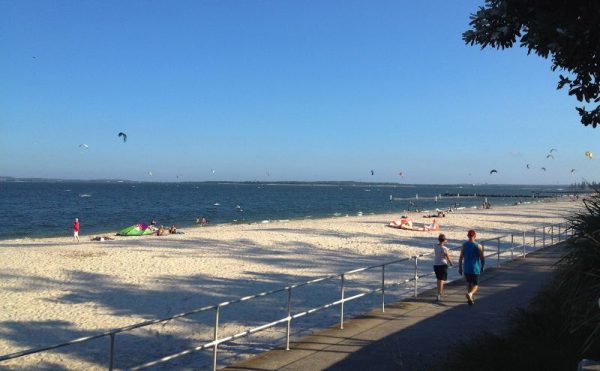
The 4–5km path hugs Botany Bay from Brighton‑Le‑Sands to Sans Souci, offering calm bay views instead of crashing surf. Lady Robinsons Beach stretches all the way from the Cooks River to the Georges River, with a level shared path, netted baths and parks along most of the route.
While it lacks the drama of the clifftop walks, it makes up for it with complete accessibility and plenty of facilities. You can walk from Captain Cook Bridge at Sans Souci all the way to Kyeemagh, with just one short section moving away from the shoreline for a few hundred metres.
What family-friendly features make this walk special?
- Shared walking and bike path – A wide, level path runs almost the entire way, perfect for bikes, scooters, prams and wheelchairs.
- Two netted swimming areas: Two shark‑netted baths provide safe swimming for nervous swimmers and young children.
- Wave‑jumpers show: On windy days, local thrill‑seekers jump in the spray along the seawall, providing free entertainment for spectators.
- Plane‑spotting near Mascot: Aviation fans will love watching planes take off and land at nearby Sydney Airport.
- Large parks with BBQs and playgrounds: Multiple foreshore reserves offer free BBQs, play equipment and shaded picnic tables, ideal for full‑day outings
A big bonus is that the path can be almost deserted on weekdays, particularly in autumn and winter. Check out our guide to Brighton Le Sands before you visit.
Practical information: Brighton‑Le‑Sands to Sans Souci
- Distance: About 4km one way, with options to extend further towards Kyeemagh or the Georges River.
- Public transport: Easy; buses run the length of the beach, with connections from Rockdale, Kogarah and services from the city such as the 303 (check current routes).
- Wheel friendly: Yes. This is one of Sydney’s most accessible coastal paths.
- BBQs: Yes, in multiple parks all along the foreshore.
- Dog‑friendly: Dogs are permitted on‑leash on the path and in some reserves but not on the beach; check local signage.
- Playgrounds: Several playgrounds along the walkway within foreshore parks.
- Nearby dining: Plenty of options at Brighton‑Le‑Sands (clubs, cafés, restaurants, fish and chips) and more casual spots closer to Sans Souci.
Insider tip: There is almost no shade along the way, so be sure to bring a hat and sunscreen.
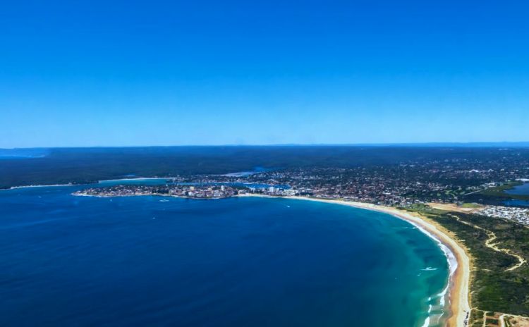
Cronulla Beach Coastal Walk (4km)
Want to reach beautiful beaches by train? Cronulla’s beaches are unique in Sydney: they are the only ocean beaches you can reach directly by train.
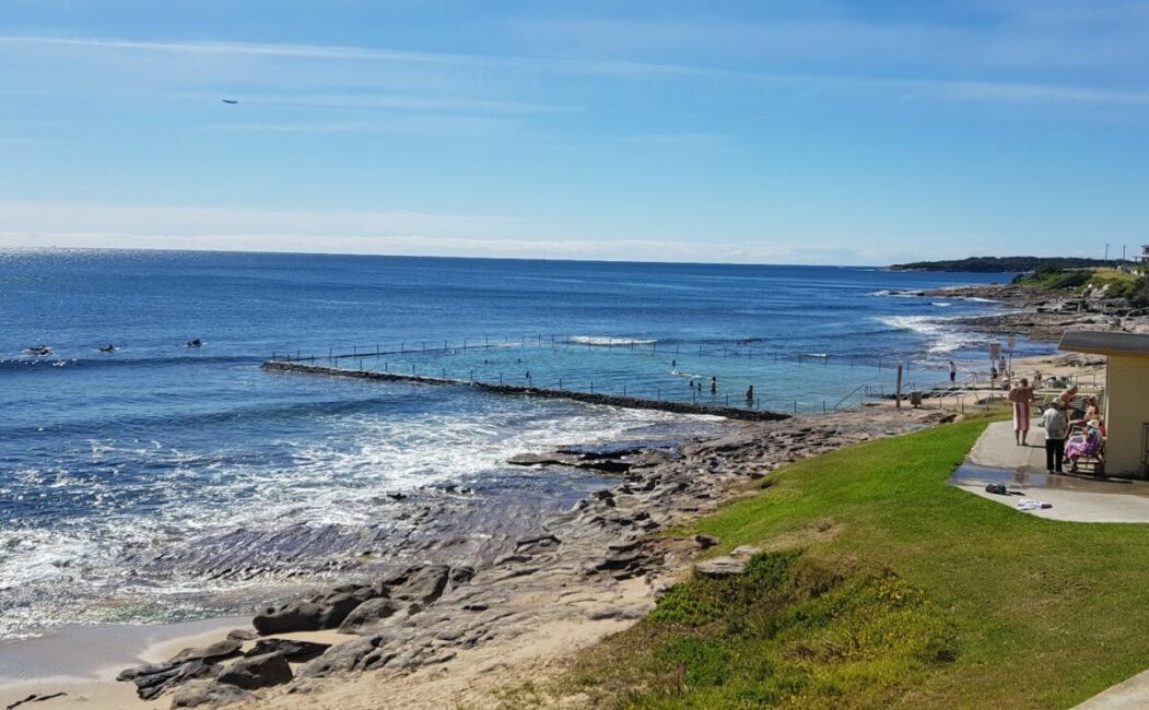
This 4km coastal walk links six beaches – Wanda, Elouera, North Cronulla, South Cronulla, Blackwoods and Shelly – each with its own character for families, surfers and walkers. One of the highlights is the string of ocean pools and rock platforms that punctuate the route.
What makes Cronulla special is the combination of excellent facilities, multiple ocean pools and a village feel where the beach is still only a couple of blocks from cafés and restaurants.
What makes Cronulla special is the combination of excellent facilities, multiple ocean pools, and that village feel where the beach is just two blocks from excellent cafes and restaurants. It’s proper family-friendly without being sanitised.
Why choose Cronulla for ocean‑pool swimming?
- Multiple ocean pools – A series of heritage‑style pools carved into the rocks provide protected swimming with different depths and orientations.
- Excellent children’s playgrounds – Well-maintained playgrounds strategically placed along the route, perfect for breaking up the walk with kids
- Nuns Pool – A beautiful natural rock pool at the southern end, offering sheltered swimming in a stunning setting
Insider tip: Darook Park, just around from the end of the walk, is a great picnic spot with plenty of shade and a lovely beach.
Practical information: Cronulla coastal walk
- Distance: About 4km one way following the promenade and headlands.
- Public transport: Super easy. Cronulla is the only Sydney beach with its own train station a short stroll from the sand.
- Wheel friendly: Largely yes along the main promenade, with some hills and slopes past South Cronulla.
- BBQs: Yes, at Shelly Park, Oak Park and several other reserves.
- Dog‑friendly: Dogs are allowed on‑leash in some park and path areas but not on the patrolled beaches; check local signage.
- Playgrounds: Several playgrounds in parks along the walkway.
- Nearby dining: Many cafés, clubs, restaurants and takeaway spots clustered around Cronulla’s main streets and near the station.
Discover more beaches in Sydney by public transport using our detailed guide. Want to keep walking? Jump on the ferry over to Bundeena.
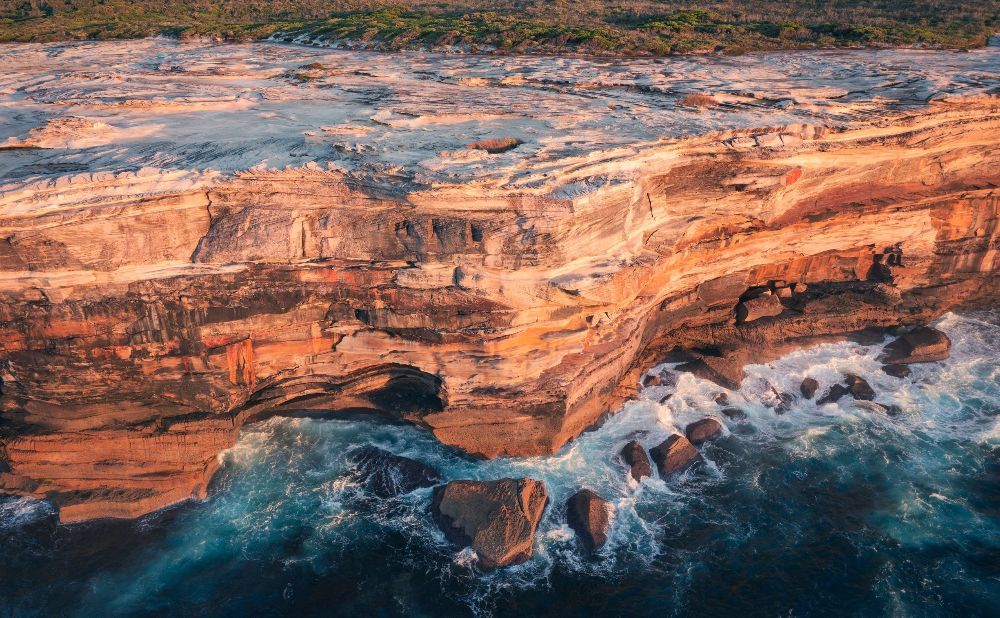
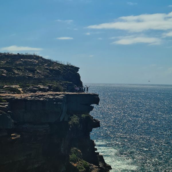
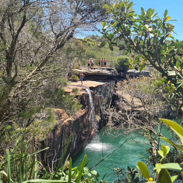
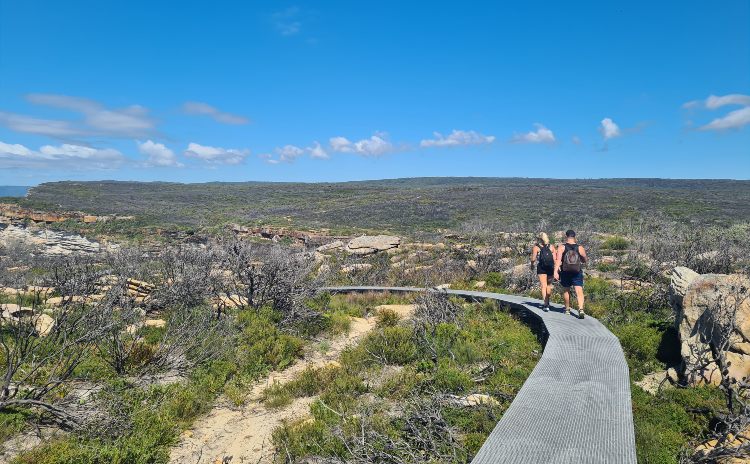
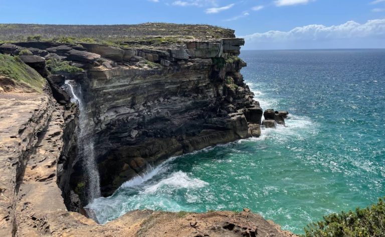
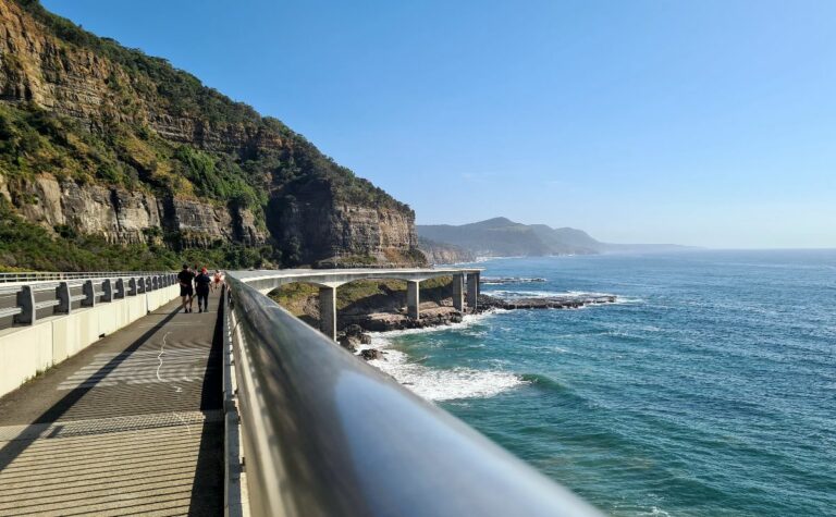
The Coast Track, Royal National Park (26km)
Ready for Sydney’s ultimate coastal wilderness adventure? The Coast Track in Royal National Park is Sydney’s most spectacular coastal walk – and also the most demanding.
This 26km multi‑day trek runs between Bundeena and Otford and takes you through some of the most pristine coastal wilderness in NSW. Expect secluded beaches, Aboriginal rock art sites, waterfalls, wild heathlands and dramatic cliff formations that few visitors ever see.
It is not for everyone. This is serious bushwalking that requires planning, a reasonable level of fitness and respect for rapidly changing coastal conditions. For those who take it on, the rewards are extraordinary.
What wilderness treasures await on the Coast Track?
- Dharawal Aboriginal engravings along the Jibbon Beach Loop Track – Ancient rock carvings that connect you to thousands of years of Aboriginal culture and connection to this coastline
- Wedding Cake Rock – The famous layered sandstone formation (view from designated areas only due to erosion)
- Wattamolla – A lagoon and waterfall where you can swim in sheltered water just metres from the sea.
- Eagle Rock – A dramatic rock formation and a waterfall that can plunge directly into the ocean after rain.
- Curracurrong Falls – A spectacular waterfall that plunges directly into the ocean (seasonal)
- Garie Beach and Burning Palms – Remote surf beaches accessible only on foot, offering pristine swimming and surfing
- Figure Eight Pools – Naturally formed rock pools shaped in figure eights; access is very tide‑ and swell‑dependent, and NPWS strongly advises checking safety guidance before attempting to visit.
I recommend you tackle this 26km track over two days, although some people manage to do it in one long hard session.
You can do it easily in three one day walks.
- Jibbon Beach to Wattamolla
- Wattamolla to Curracurrong Falls or on to Garie Beach
- Garie to Otford
If you go for the two-day option, the North Era campground is the official overnight stop. Check National Park alerts before you plan, as there are some closures in place at the moment. We have a detailed guide to walks in the Royal National Park here.
Practical information: Coast Track, Royal National Park
- Distance: 26km one way between Bundeena and Otford.
- Public transport: Train to Cronulla plus ferry to Bundeena at the northern end; train to Otford at the southern end.
- Wheel friendly: No; this is a rough Grade 5 track with steps, steep sections and uneven surfaces.
- BBQs: None along the remote sections; facilities exist at some car parks and picnic areas but not on the main track.
- Dog‑friendly: No dogs are permitted in Royal National Park.
- Playground: No on the track itself.
- Nearby dining: Pick up supplies at Cronulla or Bundeena before you start; food options on‑track are extremely limited (seasonal kiosks may operate at Garie).
Planning Your Perfect Sydney Coastal Walk Experience
How do I choose which coastal walk suits me best? Consider your fitness level, available time, and what experience you’re seeking. Beach lovers should start with Bondi to Coogee, families need Brighton to Sans Souci, and serious hikers will love the Royal National Park Coast Track.
When is the best time for coastal walking in Sydney? Year-round walking is possible, but autumn (March-May) and spring (September-November) offer the most comfortable temperatures. Summer requires early starts to avoid heat, while winter provides clear days perfect for whale watching.
Please note: Public transport information is current as of January 2025. Bus routes and timetables change regularly, so always check the latest schedules using the Transport for NSW trip planner or real-time apps before travelling.
We hope you enjoy these great walks in Sydney. If you want more walking ideas for around Sydney, check out these articles:
- Best Sydney Harbour Walks
- Short Blue Mountains Bush Walks
- Easy Family bush walks
- Sydney Harbour Walks
- Walks in your local area
I don’t mind a stroll along the coastline. I have walked the Coogee to Bondi on a couple of occasions when I’ve been visiting Sydney. I now have whole new list of walks. Sydney is so blessed with such a picturesque coastline and harbour.
These are all BEAUTIFUL! I’m hoping I make it to Australia someday, but in the meantime, I will admire these pictures 🙂 Thanks for the great tips!
Hope we see you soon Jordon
Thanks for all these wonderful suggestions!! I’m a big walker (try to get 20-30k steps a day) so these are the perfect activities for me!! Can’t wait to go back to Australia.
I love this! I can’t wait until I can visit Sydney one day. I also think it’s really great that you have made this post focus on accessibility too. It has made me realise how people don’t tend to write about that aspect when we should. Thank you for this <3
This is awesome! I’ve been to Sydney twice and last time I was really staying near the coast, it was soooooo nice!!! I haven’t got enough chance to explore Syndey’s other beaches, should do next time!
A recent back injury it reminded me how important this is!