Using Sydney’s Public Transport 2026
Getting around Sydney without a car is straightforward once you know the basics. Trains, metros, buses, and ferries cover most areas you’ll want to visit, and they’re often faster than driving. You’ll need either an Opal card or a contactless bank card to travel, and I recommend downloading a transport app to help plan your trips.
This guide is perfect for first-time visitors and budget travellers. You will learn how to navigate Sydney without a car, pay for transport, which routes serve major attractions, money-saving tips, and how to navigate like a local.
Fully updated 4 February 2026
Using the Sydney Airport Train
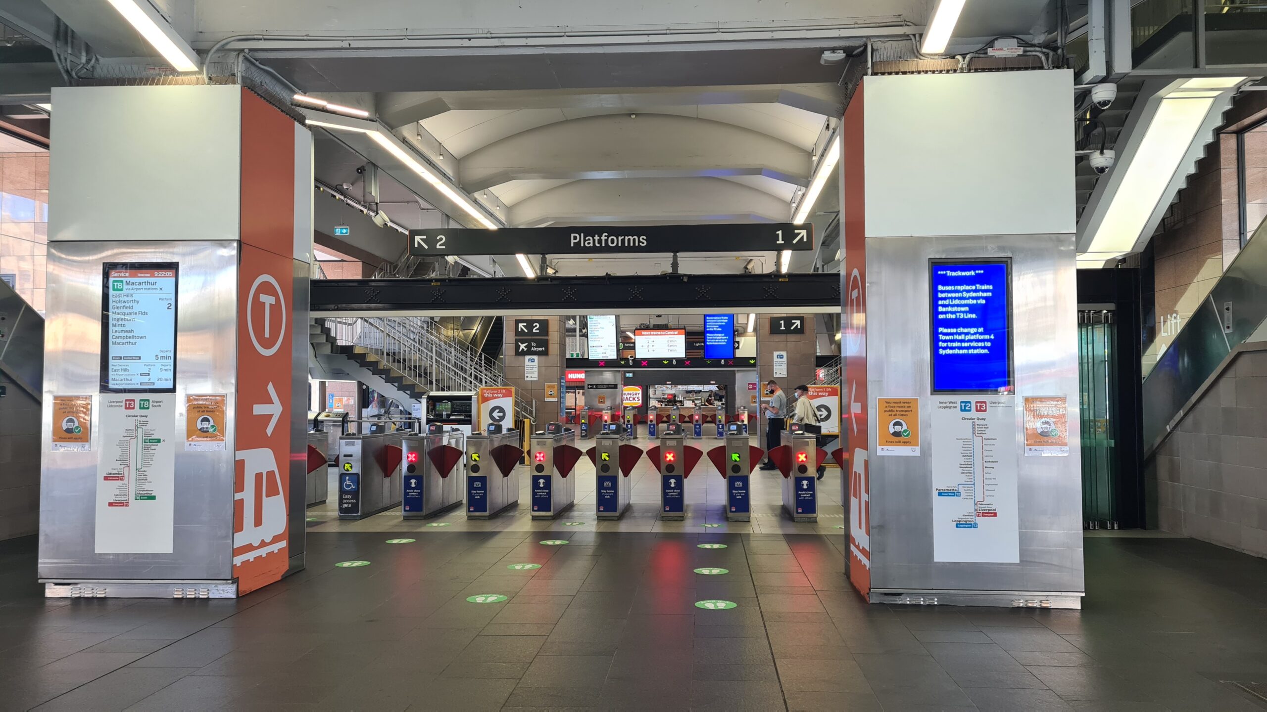
For most people, the airport train (T8 line) will be your first taste of Sydney’s Public Transport network.
The Airport Link train offers the fastest route to Sydney’s city centre, taking just 13 minutes to Central Station compared to 30-60 minutes by taxi during peak traffic. Depending on the time you arrive, this could be a pleasant or pretty stressful experience.
The two stations at the airport are privately operated, and access includes a gate fee.
Airport train costs to the city centre in 2026:
- Peak fare (weekdays 7-9am, 4-6:30pm): $22.25
- Off-peak fare: $20.95
- Gate fee: $17.92 (included in total fare)
Is the airport train worth it? Yes, if you’re traveling with 1-2 people. A taxi to the city costs $50-70, making the train significantly cheaper. Plus, you’ll beat the traffic that often delays road transport by 20-30 minutes during busy periods.
The trip from the international airport to the city takes approx 13-18 minutes. Trains run every 8-15 minutes. During busy periods, you’ll likely reach the city before you’d even get to the front of the taxi queue.
Trains begin running in both directions just before 4.30am and the last airport train departs the airport just after midnight. Check the trip planner for exact times.
Have a read of our airport train tips and decide if the train is right for you.
I used to take this train every day. When everyone is heading to and from work the trains are pretty crowded and not for the faint-hearted. Before the train arrives, check the platform indicators – they show you which carriages are likely to be least crowded so you can position yourself accordingly. If you can, avoid standing right in the doorway so you are not blocking the entry.
If you have a huge backpack, take it off your back – it’s the polite thing to do 🙂
How Much Does Public Transport Cost in Sydney?
Understanding Sydney’s fares helps you budget for your trip. Here’s what you need to know.
Daily caps protect you from overspending. Travel as much as you want and you’ll never pay more than:
- $19.30 per day Monday to Thursday
- $9.65 on Friday, Saturday, Sunday and public holidays
- $50 per week
Typical single fares range from $3.20 to $5.40 for most trips within the city and inner suburbs. Longer journeys to places like the Blue Mountains cost $8-15 depending on distance.
Children aged 4-15 travel for roughly half the adult fare with daily caps of:
- $9.65 per day Monday to Thursday
- $4.80 on Friday, Saturday, Sunday and public holidays
- $25 per week
Gold Opal card (seniors/pensioners with NSW concessions): Travel for a maximum of $2.50 per day or $17.50 per week.
Money-saving tip: The cheapest way to explore Sydney is on Fridays and weekends when the $9.65 cap applies. You could take the ferry to Manly, catch the light rail to the Fish Market, and explore multiple suburbs by train – all for less than $10.
Transfer discounts: You get a $2 discount (adult) or $1 discount (child/concession) when you transfer between different transport modes within 60 minutes as part of one journey.
Off-peak discount: Travel outside peak hours (before 7am, between 9am-4pm, or after 6:30pm on weekdays) and save 30% on your fare.
Learn more about fares and benefits in our guide to using Sydney’s Opal Card.
Sydney Trains: Getting Around the City and Beyond
Sydneysiders love to complain about our rail network, but for visitors exploring the inner city and nearby attractions, it’s a reliable and convenient way to get around.
Need help with fares and ticketing options? Check our guide to Using Sydney’s Opal Card
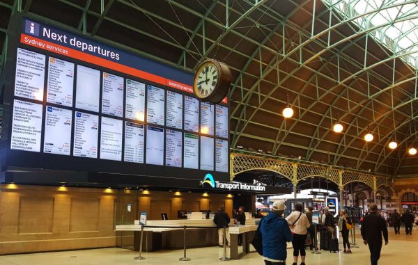
The heart of Sydney’s train network is Central Station, located between Chinatown and Surry Hills. All trains pass through this station, including country services to the Blue Mountains, Melbourne, Brisbane and beyond.
If you are planning a train trip to the Blue Mountains, you will probably depart from Central.
The other key stations for travellers are part of the City Circle, a loop of stations that form a ring around the CBD or central business district. These stations include Central, Town Hall, Wynyard, Circular Quay, St James and Museum. The city circle runs in both directions and is an excellent way to get from one end of town to the other if your feet give up!
The nearest City Circle Stations to main attractions are:
- Central – Paddy’s Market, Chinatown, Surry Hills and Chippendale (Central Park complex)
- Town Hall – QVB, Darling Harbour, George Street light rail
- Wynyard – Barangaroo and Martin Place
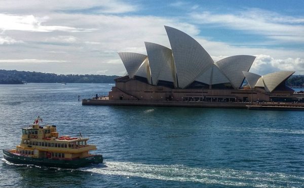
- Circular Quay – Ferries, Opera House and The Rocks
- St James – Pitt Street Mall, Hyde Park Barracks, St Mary’s Cathedral
- Museum – Australian Museum, War Memorial, William Street to Darlinghurst
A train ride to one of Sydney’s suburbs like Newtown or Cronulla is also an excellent way to spend a few hours exploring a different part of the city.
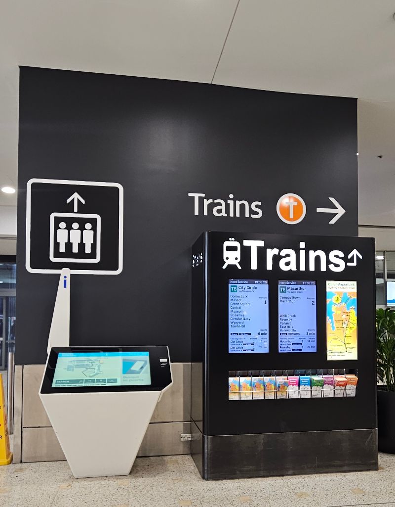
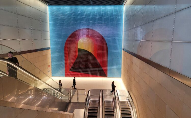
Sydney Metro
The Metro has changed the way Sydneysiders move around the city. It’s made it quicker to travel from the city centre to places like Barangaroo and North Sydney. I love how easy it is to use. The trains are fully automated, air-conditioned, and have platform screen doors for safety. Trains run every 4 minutes in peak times, and the stations are spacious, well-designed and fully accessible with lifts at every station.
What makes Metro different: Unlike regular trains, all Metro stations have level boarding (no gap between platform and train), making it easier with luggage or mobility aids. The system also runs later on weekends – until around 1am Friday and Saturday nights.
There are currently two lines to choose from:
- Metro North West Line runs from Tallawong to Chatswood
- City & Southwest Line connects Chatswood to Bankstown through the CBD
The network is expanding with the Western Sydney Airport Metro line opening in 2026, eventually connecting the new airport to the existing network.
Key Metro Stations for Visitors
Several Metro stations provide convenient access to Sydney’s most popular attractions:
- Central Station: The city’s main transport hub, offering easy access to Sydney Tower Eye and the vibrant Haymarket district with its diverse dining and shopping options.
- Town Hall Station: Perfect for visiting the historic Queen Victoria Building (2-minute walk), Darling Harbour (8 minutes), and connects to light rail for the Sydney Opera House area.
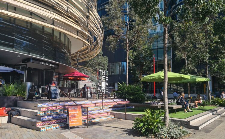
- Barangaroo Station: Direct access to Barangaroo Reserve (3-minute walk), waterfront dining, and harbour views. An ideal starting point for exploring this modern waterfront precinct.
- Martin Place Station: Located in the heart of the CBD, 5-minute walk to historic sites, premium shopping areas, and connects to Wynyard train station via underground walkway.
- Gadigal Station: Gateway to the Australian Museum (8-minute walk) and the trendy neighbourhoods of Surry Hills and Redfern, known for their art galleries, cafes, and restaurants.
- Sydenham Station: Hub of Sydney’s craft beer scene with multiple breweries within 10-15 minutes’ walk, plus live music venues and an emerging arts district in nearby Marrickville.
Learn more about what you will find at Sydney’s new Metro stations.
Sydney Light Rail: Connecting City, East, and Inner West
Sydney’s light rail system offers a scenic way to travel between the city centre and popular destinations like the Fish Market, Circular Quay, and Randwick. The trams are modern, air-conditioned, and run frequently throughout the day.
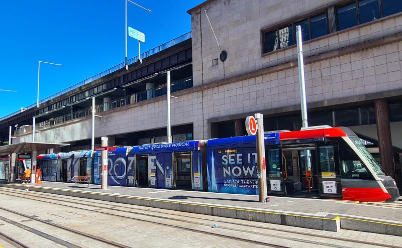
L1 Route: Central Station → Star Casino → Dulwich Hill → Inner West
Running time: 45 minutes end to end | Frequency: Every 7-15 minutes
Key stops for visitors:
- Fish Market: Sydney Fish Market and waterfront dining (15 minutes from city)
- The Star: Casino, restaurants, and harbour views
- Glebe: Trendy cafes and weekend markets
- Tramsheds: Food precinct and specialty shopping
L2 Route: Circular Quay → Surry Hills → Randwick
Running time: 35 minutes end to end | Frequency: Every 8-15 minutes
This route travels along George Street through the heart of the city before heading southeast.
Key stops for visitors:
- Circular Quay: Opera House, harbour ferries, and The Rocks (5-minute walk)
- QVB: Queen Victoria Building and premium shopping
- Central: Main transport hub and Chinatown
- Surry Hills: Trendy pubs, restaurants, and boutique shopping (Crown Street)
- Moore Park: Allianz Stadium, SCG, and Entertainment Quarter
- Randwick: Racecourse, dining precinct, and UNSW campus
L3 Route: Central → Kingsford
Running time: 25 minutes end to end | Frequency: Every 10-20 minutes
Key stops for visitors:
- Central: Connect to all train lines
- High Street: Randwick shopping and dining
- UNSW Kingsford: University campus and student areas
Light rail operating hours: Approximately 5am to midnight daily, with extended service until 1am on Friday and Saturday nights.
Tip: Light rail stops are marked with distinctive glass shelters and electronic displays showing next arrival times. All services accept Opal cards and contactless payments.
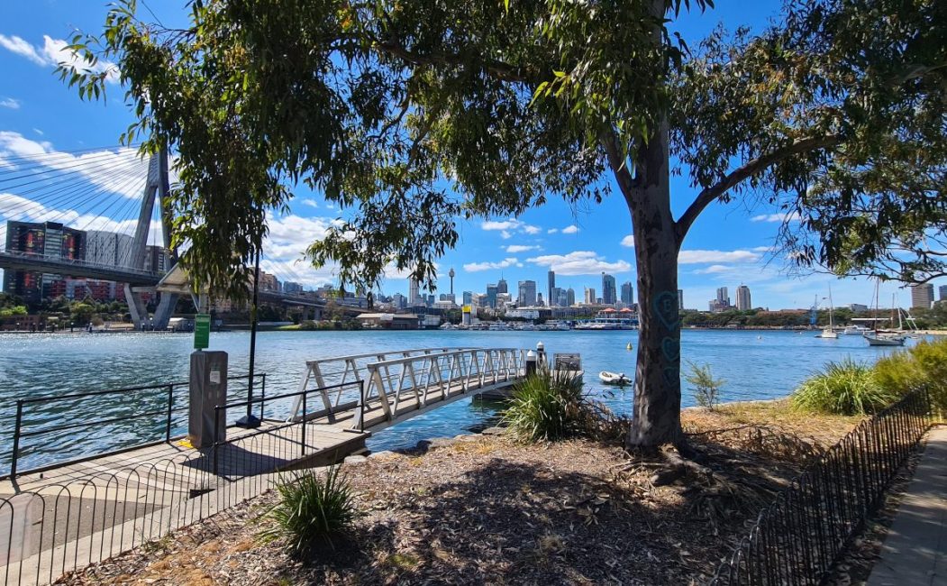
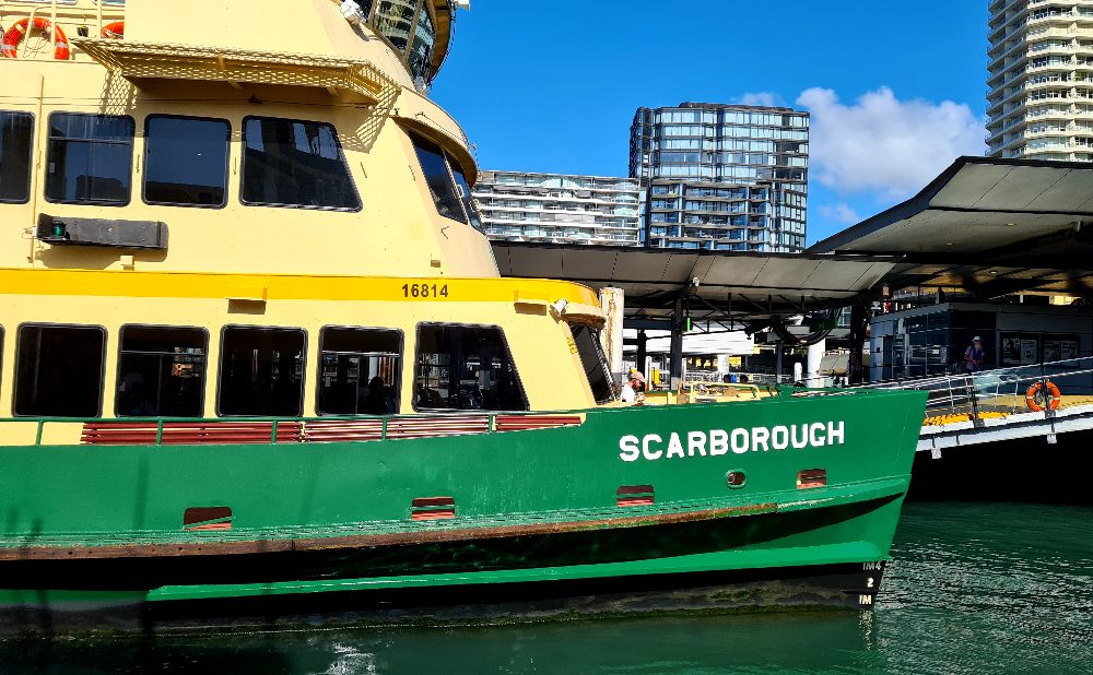
Sydney Ferries: The Best Way to See Sydney Harbour
Taking a ferry is my favourite way to travel in Sydney – it turns a regular commute into a harbour cruise! The public ferry network covers most harbour suburbs, and you can use your Opal card or credit card to pay.
Ferry operating hours: Most routes run from 6am to 11:30pm, with reduced weekend schedules. The famous Manly ferry runs every 30 minutes during the day.
The most useful ferry routes for visitors:
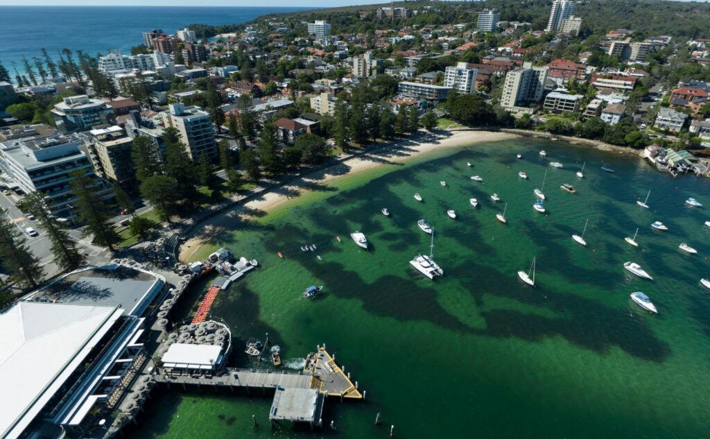
- Manly Ferry: 30-minute scenic journey to Manly Beach – considered a must-do Sydney experience with stunning harbour views
- Parramatta River: 90-minute journey to Sydney’s second CBD, passing historic sites and parklands
- Eastern Suburbs: Quick trips to Watson’s Bay (25 minutes) for harbour beaches and Rose Bay for seaplane watching
- North Shore: Services to Mosman (15 minutes) and Cremorne Point (20 minutes) for harbour views and walking tracks
- Inner West: Balmain ferry (15 minutes) for weekend markets and waterfront pubs
Ferry fares: Similar to train fares, typically $4-8 depending on distance. The Manly ferry costs $8.90 each way
There are also private ferry services that complement the public network:
- Manly Fast Ferry: Quicker 18-minute journey to Manly (accepts Opal cards, counts towards daily caps)
- Captain Cook Cruises: Harbour services and sightseeing cruises with hop-on-hop-off options
- Scenic day trip ferries:
- Brooklyn River Ferry: 2.5-hour journey through scenic Hawkesbury River
- Church Point services: Access to Northern Beaches communities via water
- Bundeena Ferry: 45-minute trip to Royal National Park beaches
Note: While some private services accept Opal cards, these trips don’t always count towards your daily or weekly fare caps.
Explore Sydney by Ferry
Sydney Buses: Getting to Beaches and Suburbs Without Trains
I use Sydney’s buses almost daily when I am in Sydney, and they’re particularly useful for reaching the Eastern and Northern suburbs where there are no trains.
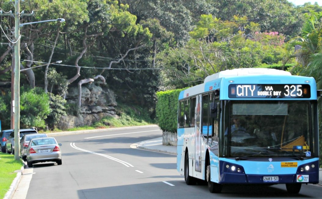
Buses are your best option for getting to Bondi, Coogee and the Northern Beaches. I use Sydney’s buses almost daily, and they’re particularly useful for reaching areas where trains don’t go – like the Eastern and Northern suburbs.
The best bus routes for visitors to Sydney
Some of my favourite bus routes for visitors double as sightseeing tours, taking you to places trains can’t reach. I’ve written detailed guides for exploring Sydney by bus, including the most scenic routes:
- Route 389: Pyrmont → City → Bondi Beach (45 minutes) – Perfect for beach days, passing through trendy Paddington and ending at Australia’s most famous beach. Full route guide here
- Route 325: Walsh Bay → Watsons Bay (35 minutes) – Spectacular harbour views, passing Rose Bay and Double Bay’s luxury shopping. Ends at Watsons Bay for fish and chips with harbour views. Detailed route info
- Route 311: Barangaroo → Woolloomooloo (20 minutes) – Short but scenic journey through the city centre, perfect for connecting waterfront dining precincts. Route highlights
Payment: You’ll need either an Opal card or contactless payment (credit card or digital wallet) – cash isn’t accepted on any Sydney buses.
Operating hours: Most bus routes run from 5am to midnight, with reduced services on weekends and Night Ride buses on key routes after midnight Friday and Saturday nights.
- Download the Transport NSW app for real-time bus tracking
- When you are at the bus stop hail the bus by raising your hand. Buses may not stop at smaller stops unless requested.
- Board through the front door and tap your card on the green Opal reader
- Press the stop button before your destination (buses won’t stop unless requested)
- Popular beach routes can be crowded on sunny weekends – allow extra time.
Rideshare and Taxis: When Public Transport Isn’t Convenient
When public transport isn’t convenient, rideshare services offer a reliable alternative. For late-night travel, getting to areas poorly served by public transport, or when you’re carrying heavy luggage. I use them regularly and find them safe and efficient, especially for airport transfers and beach-hopping between .
Current rideshare options in Sydney:
- Uber – The most widely used service
- Didi – Often cheaper than Uber
- 13cabs and Silver Service apps – Traditional taxi companies with modern booking systems
At Sydney Airport, all rideshare services have designated pickup zones at both terminals – just follow the signs. First-time users can often find signup discounts through the apps. Save time by downloading them before you arrive. Your Uber account from your home country will work.
Airport Pickup Locations:
- International Terminal: Priority pickup area
- Domestic Terminal: Express pickup zone
Check out our guide to using Sydney Airport, which includes details of all the airport’s transport options.
Late Night Travel Options
For late-night travel, I recommend using either rideshare services or taxis from secure ranks. These well-lit, monitored taxi ranks operate Friday and Saturday nights (8pm-3:30am) at key locations:
- Darling Harbour (Lime Street)
- Circular Quay (Alfred Street)
- The Rocks (Argyle/Harrington Streets)
- CBD (Chifley Square)
- World Square (George Street)
If you prefer traditional taxis, Silver Service and 13cabs both offer reliable booking apps.
Night Ride buses: Limited bus services run on major routes after midnight Friday and Saturday nights. Check the Transport NSW app for “NightRide” routes – they’re cheaper than rideshare but less frequent (every 30-60 minutes).
Water Taxis
Water taxis are a quick, private alternative to ferries when you need a specific drop‑off at a hotel or restaurant jetty. They’re best for small groups splitting the cost or when public ferries don’t stop where you need to go.
Typical costs and time expectations
- Short private transfers often start from around AUD 50–70.
- Inner‑harbour point‑to‑point trips (for example Circular Quay ↔ Darling Harbour) are commonly AUD 100–250.
- Hourly charters usually begin around AUD 150–350; expect extra charges for waiting or late‑night bookings.
- Journey times are short (roughly 5–25 minutes) but vary by vessel and stops.
Popular routes include:
- Circular Quay ↔ Darling Harbour: ~5–15 minutes
- Circular Quay ↔ Rose Bay: ~15 minutes
- Cross-harbour trips (like Balmain to Mosman)
- Balmain ↔ Barangaroo: ~10–20 minutes(Times vary with vessel type, stops and harbour traffic.)
How to book and what to check:
- Book direct on operator websites (H2O, Majestic, Sydney Cove Water Taxis) or by phone for an instant quote.
- Always ask for a written price that includes any wait or after‑hours fees.
Car Rental: When You Need to Leave Sydney
If you are wondering if you should you rent a car to use in Sydney my short answer is no. Most visitors won’t need one for exploring the city – public transport is faster and cheaper for inner Sydney attractions. However, a car becomes useful for day trips to places like the Hunter Valley wineries, South Coast beaches beyond Wollongong, or exploring multiple Blue Mountains towns in one day.
When car rental makes sense
If you’re planning multi-stop road trips, staying in outer suburbs, or visiting areas with limited public transport. Daily rental rates typically start from $40-60 for economy cars, plus fuel and parking costs.
The reality of driving in Sydney
City parking costs $4-8 per hour in metered areas, with hotel parking often adding $25-45 per night. Traffic is heavy during peak hours (7-9am, 4:30-7pm), and many attractions have limited parking. For inner-city sightseeing, public transport will save you time and money.
International visitors can drive in Australia with an overseas license for up to three months, but consider getting an International Driving Permit before you travel for easier car rental processes.
Rental options
Use an aggregator like Discover Cars to compare major companies (Hertz, Avis, Budget) all operate from the airport and city locations. For local alternatives, Bayswater Car Rental offers competitive city-centre rates and straightforward terms.
Best Apps for Sydney Public Transport
After trying most of the transport apps available for Sydney, I always recommend visitors start with Citymapper. It’s cleaner and more intuitive than the official Transport NSW app, especially when you’re trying to figure out the fastest route between attractions.
Essential apps to download before you arrive
Transport NSW Trip Planner – The official app
- Real-time updates and service alerts
- Detailed trackwork information
- Trip planning with multiple route options
- Essential for checking weekend service changes
Citymapper – My top recommendation for visitors
- Shows the fastest route combining all transport options
- Clean interface that’s easy to understand
- Tells you which carriage to board for quickest station exits
- Works well for tourists unfamiliar with Sydney
Alternatives:
Opal Travel – For managing your Opal card if you decide to use one.
- Check your card balance on the go
- Top up your Opal card
- View your trip history
- Track your progress towards weekly caps
TripView – Best for regular travellers
- Save your frequent routes for quick access
- Get push notifications about service changes
- Available in free and paid versions
- The paid version ($5) is worth it if you’re staying more than a month
Download at least one of these before you arrive in Sydney to make getting around easier.
Google Maps also works well for basic journey planning in Sydney and integrates public transport directions.
Tip for saving mobile data: Download offline map apps before arriving. They’re useful for walking directions between stations and attractions.
Planning Your Journey
Sydney’s public transport network might seem complex at first, but with an Opal card and a transport app on your phone, you’ll be exploring like a local in no time. Remember:
- Save money by traveling on Friday, Saturday and Sundays when fares are capped at $8.90
- Check for trackwork before weekend travel
- Allow extra time during peak hours (8-9:30am and 4:30-6pm weekdays)
- Remember Opal cards are needed for kids fares.